
SAN ANGELO, TX — The National Weather Service is warning of potentially severe thunderstorms Saturday across West Central Texas, including San Angelo, with large hail and damaging winds possible late in the day.
Storms are expected to develop along the dryline by late Saturday afternoon or early evening and continue into the night. San Angelo, Abilene, and Brownwood are under a “Slight Risk” (Level 2 of 5), meaning short-lived but intense storms could occur.
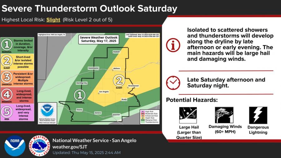
Main hazards include hail larger than quarters, wind gusts over 60 mph, and frequent lightning.
In addition to storm threats, above-normal temperatures will persist through early next week. San Angelo is forecast to reach highs of 97 degrees Friday and 98 degrees Saturday, with temperatures across the region climbing into the upper 90s and even 100 in some areas like Junction.

Lows will remain mild, ranging from the upper 60s to low 70s.
Residents are advised to stay weather aware and take precautions for both severe storms and heat.

")

Subscribe to the LIVE! Daily

Required
Post a comment to this article here: