
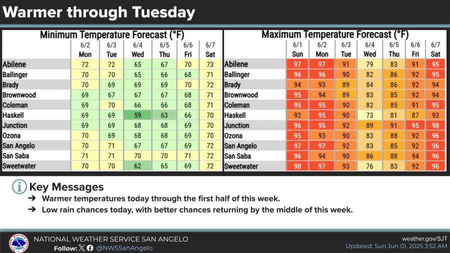
SAN ANGELO, TX — Temperatures across West Central Texas are climbing into the upper 90s to near 100 degrees Sunday and Monday, but relief may be on the way as rain chances increase by midweek, according to the National Weather Service in San Angelo.
Forecast highs for San Angelo are 97 degrees Sunday and Monday, with similar readings expected across the Big Country and Concho Valley. Cooler conditions are forecast to arrive midweek, with highs dipping into the low 80s by Wednesday.
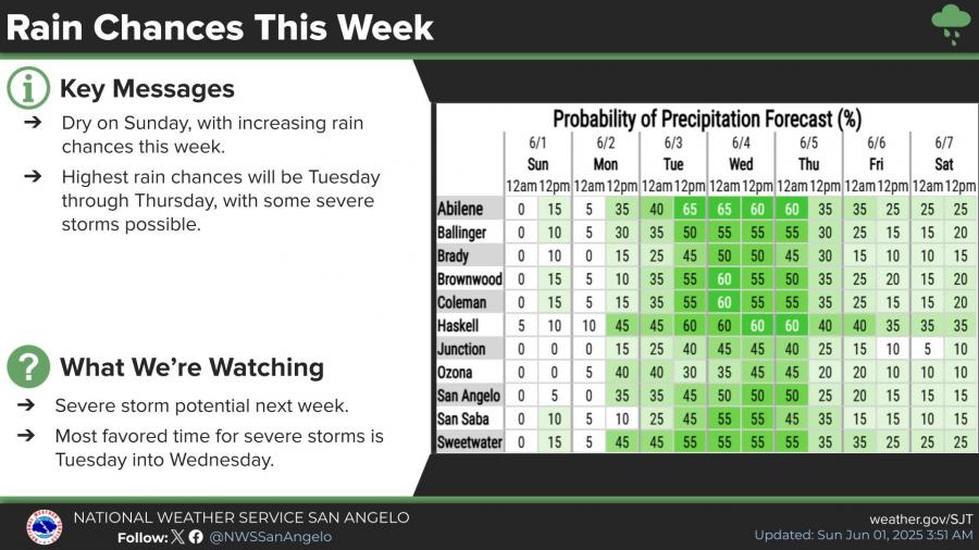
Rain chances return late Monday and increase significantly Tuesday through Thursday. The highest probability for showers and thunderstorms is expected Tuesday and Wednesday, with some storms potentially reaching severe limits.
Forecasters say today’s isolated thunderstorms — mainly north of a Sterling City to Mason line — are not expected to be widespread. However, any storms that do develop this afternoon and evening could produce quarter-size hail, damaging winds over 60 mph, and dangerous lightning.
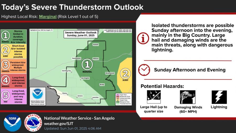
The National Weather Service categorizes Sunday’s severe weather risk as “Marginal,” the lowest level on its five-point scale. The most favored window for storm development is between 2 p.m. and 9 p.m.

")

Subscribe to the LIVE! Daily

Required
Post a comment to this article here: