
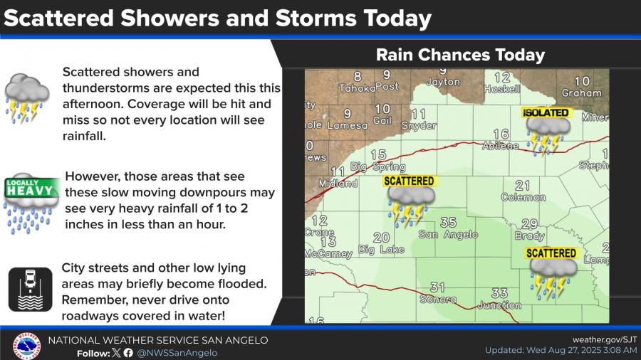
SAN ANGELO, TX — Scattered showers and thunderstorms are expected across West Central Texas today, with brief heavy downpours possible, the National Weather Service in San Angelo reports. Some storms could drop 1 to 2 inches of rain in less than an hour, leading to localized street flooding.
Rain chances are forecast to increase late this week, with the best chances for widespread rainfall arriving from Friday night through Sunday. Probabilities range from 40% to 70% across the Concho Valley and surrounding areas, including San Angelo, Abilene, and Ozona.
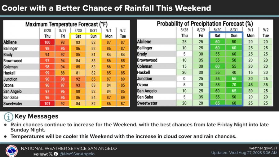
Temperatures will also trend lower, dropping from the upper 90s this week to the low to mid-80s by the weekend as cloud cover and showers spread across the region.
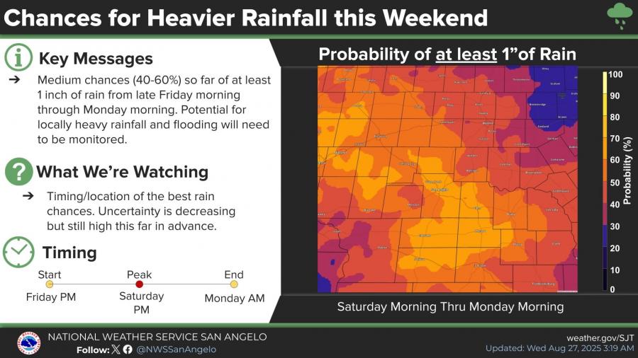
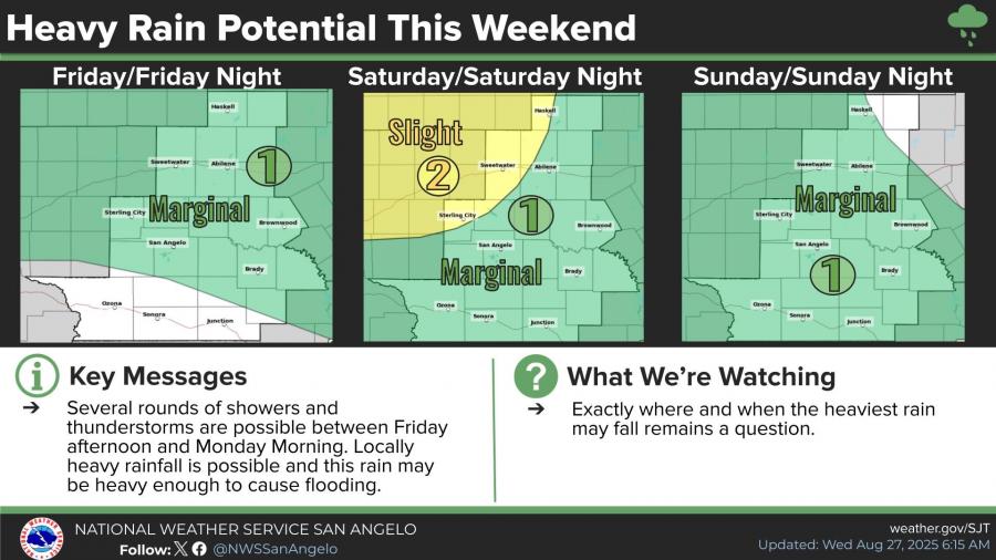
Forecasters say there is a medium chance—40% to 60%—that at least one inch of rain will fall across much of West Central Texas between late Friday morning and Monday morning. The Weather Prediction Center has issued a marginal risk of excessive rainfall for Friday and Sunday, with a slight risk for areas north of San Angelo on Saturday.
The Weather Service cautions that locally heavy rainfall may cause flooding in low-lying areas and city streets. Residents are urged to remain alert for changing conditions and to avoid driving through water-covered roadways.


")
Subscribe to the LIVE! Daily

Required
Post a comment to this article here: