
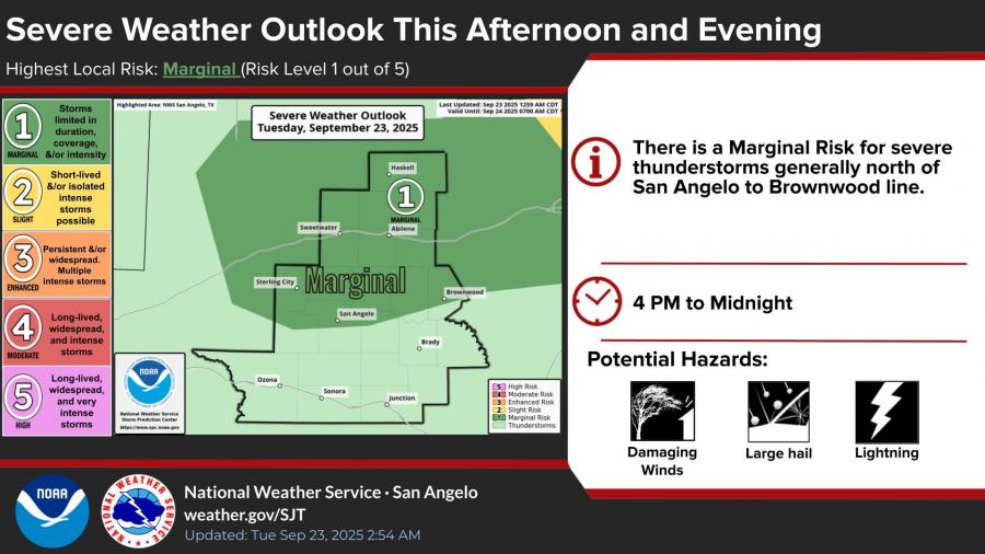
SAN ANGELO, TX — The National Weather Service in San Angelo is warning of a marginal risk for severe thunderstorms this afternoon and evening across areas generally north of a San Angelo-to-Brownwood line.
Forecasters said storms are possible between 4 p.m. and midnight, with potential hazards including damaging winds, large hail and lightning. The severe weather outlook places the risk at Level 1 out of 5, meaning storms are expected to be limited in duration, coverage and intensity.
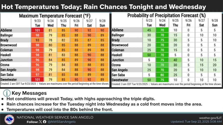
In addition to storm chances, the region will see another day of hot conditions. Highs Tuesday are expected to range from the mid-90s to 101 degrees across the Big Country and northwest Concho Valley, with San Angelo forecast to reach 98.
A cold front moving into the area late Tuesday into Wednesday will bring increased rain chances and cooler temperatures. Probabilities for precipitation climb as high as 70 to 80 percent in many locations by Wednesday. Behind the front, daytime highs will cool into the 80s for much of the region through the weekend.
The National Weather Service advised residents to monitor conditions closely and have a safety plan in place for possible severe storms.
")

Subscribe to the LIVE! Daily

Required
Post a comment to this article here: