
SAN ANGELO, TX — Rain and thunderstorms are moving across the San Angelo area Friday, with coverage expected to increase through the evening and overnight hours, according to the National Weather Service in San Angelo.
Forecasters warn that a large thunderstorm complex will move from west to east across West Central Texas late Friday into early Saturday morning. The main severe threats include damaging winds, large hail, and isolated tornadoes.
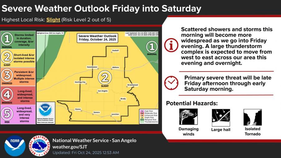
The NWS has placed San Angelo and surrounding counties under a Slight Risk (Level 2 of 5) for severe storms, along with a Slight Risk for excessive rainfall that could lead to flash flooding. Most areas are expected to receive 0.5 to 2 inches of rain, with isolated higher totals possible.
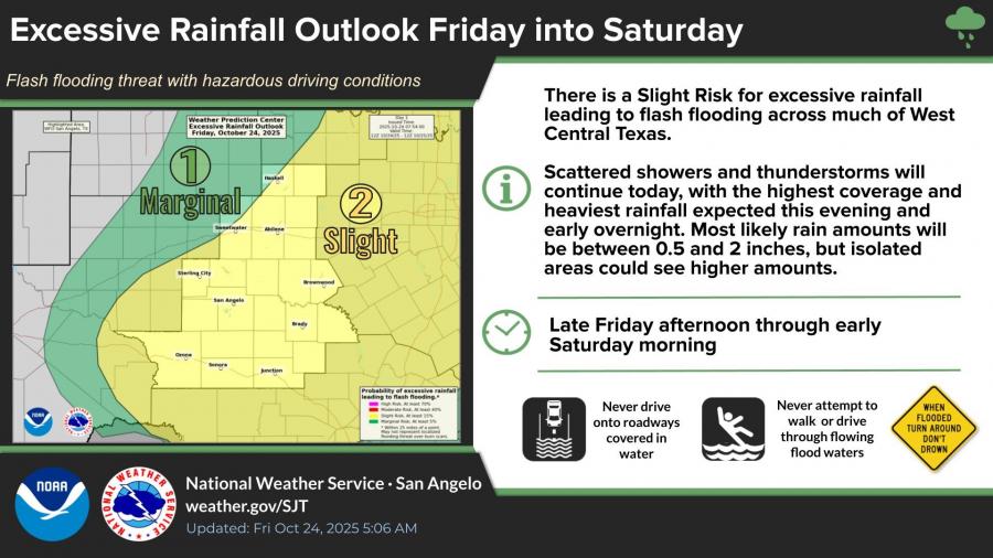
Drivers are urged to use caution and avoid flooded roads. The NWS advises: “Turn around, don’t drown.”
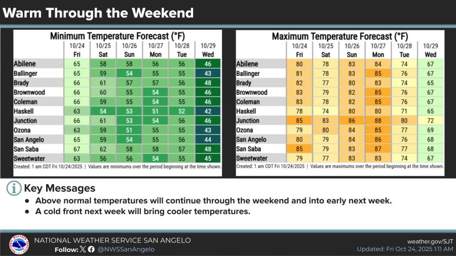
Temperatures will remain above normal through the weekend, with highs around 80 degrees and lows around 60 degrees. A cold front arriving early next week is expected to bring cooler weather by Tuesday and Wednesday.
")


Subscribe to the LIVE! Daily

Required
Post a comment to this article here: