
SAN ANGELO, TX — West Central Texas will see unseasonably warm weather through early week before rain and storm chances increase by the middle of this week, according to the National Weather Service in San Angelo.
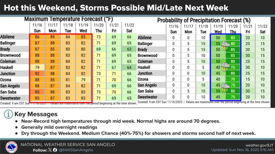
Forecasters report near-record high temperatures Sunday through Monday, with highs in many areas reaching the upper 80s to near 90 degrees. Normal highs for this time of year are around 70 degrees.
Conditions are expected to stay dry through the weekend. However, rain and thunderstorm chances rise to medium levels — between 40% and 75% — beginning Wednesday and continuing into late week. Forecast data shows the highest rain probabilities Wednesday and Thursday, along with a possible shift to cooler temperatures.
The Weather Prediction Center has issued a marginal risk for excessive rainfall from Wednesday into early Thursday, mainly for counties east of a line from Abilene to San Angelo to Sonora. Forecasters say it is still early, but rainfall amounts could reach 1 inch or more in some locations, with localized flash-flooding possible.
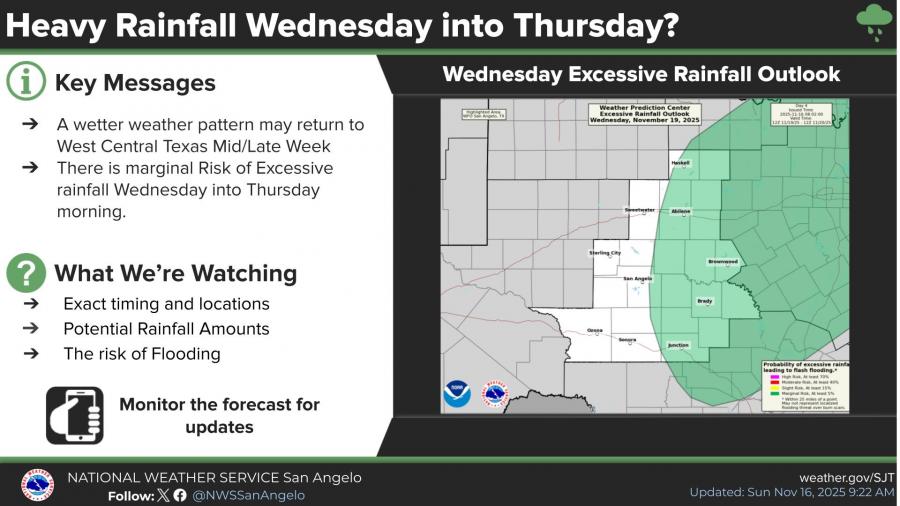
Meteorologists are monitoring the timing, coverage, rainfall totals and any flooding threat as the pattern develops.
")


Subscribe to the LIVE! Daily

Required
Post a comment to this article here: