
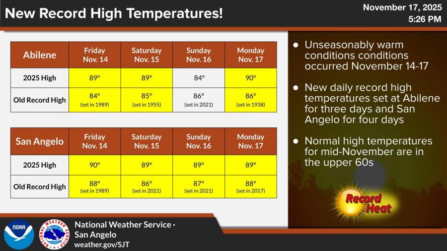
SAN ANGELO, TX — Unseasonably warm weather brought multiple new daily temperature records to San Angelo and Abilene from Nov. 14–17, according to the National Weather Service. Temperatures reached roughly 20 degrees above normal for mid-November, when typical highs are in the upper 60s.
San Angelo set new record highs all four days, reaching 90 degrees on Friday and 89 degrees Saturday through Monday. Abilene set new record highs on three of the four days, topping out at 89 degrees Friday and Saturday before reaching 90 degrees Monday.
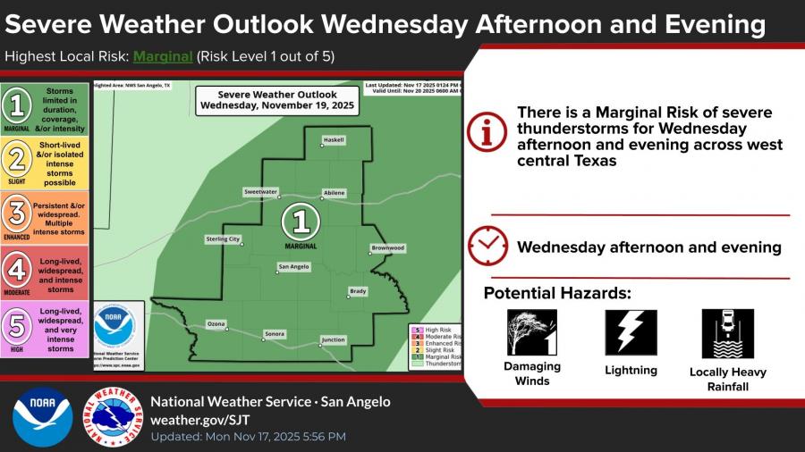
Forecasters say the pattern will shift midweek as a disturbance increases rain and storm chances. A Marginal Risk for severe thunderstorms is in place Wednesday afternoon and evening across west central Texas. Hazards may include lightning, isolated damaging wind gusts and locally heavy rainfall.
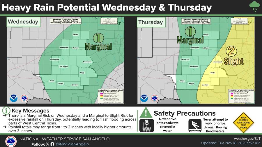
Heavy rainfall is also possible Wednesday night and Thursday. The Weather Prediction Center lists a Marginal to Slight Risk for excessive rainfall, with totals ranging from 1 to 2 inches and locally higher amounts over 3 inches. Forecasters warn that flash flooding may occur in some areas.
")


Subscribe to the LIVE! Daily

Required
Post a comment to this article here: