
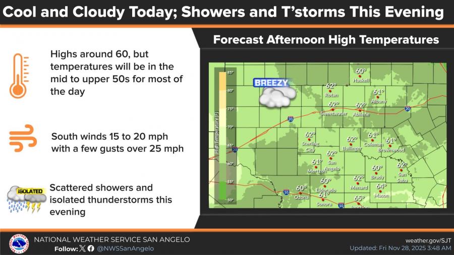
SAN ANGELO, TX — Scattered showers and isolated thunderstorms are expected across the Concho Valley today before a powerful cold front brings freezing temperatures and bitter wind chills to the region by Sunday, according to the National Weather Service in San Angelo.
Forecasters say highs today will hover near 60 degrees, though most areas will stay in the mid- to upper 50s under cloudy skies. South winds will range from 15 to 20 mph, with gusts topping 25 mph. Storm chances increase after 3 p.m., with the best opportunity for rain and isolated thunderstorms this evening.
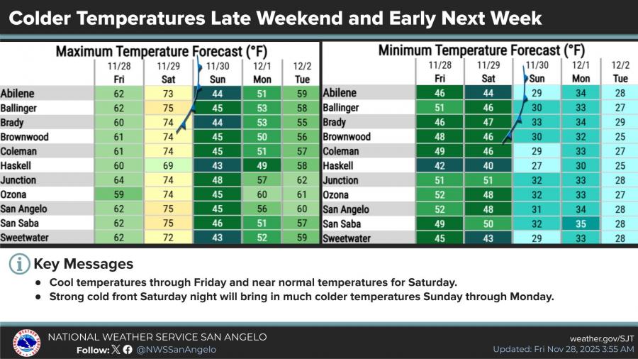
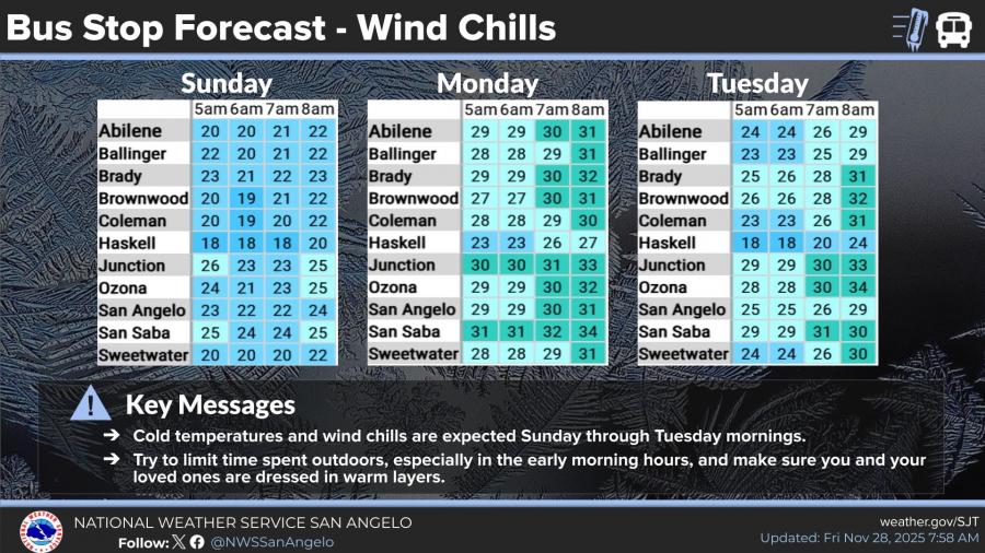
Conditions change sharply this weekend. After a warm, near-75-degree Saturday, a strong cold front will push into the area Saturday night, dropping Sunday’s high into the mid-40s. Overnight lows Sunday and Monday are forecast near freezing, with wind chills in the teens and 20s for early-morning hours from Sunday through Tuesday.
Wind-chill forecasts show San Angelo in the low 20s Sunday morning and mid-20s Monday and Tuesday mornings. The weather service advises limiting time outdoors during the early hours and ensuring children are dressed in warm layers for school.
Temperatures are expected to gradually rebound beginning Tuesday afternoon, reaching the upper 50s to near 60 mid-week.
")


Subscribe to the LIVE! Daily

Required
Post a comment to this article here: