
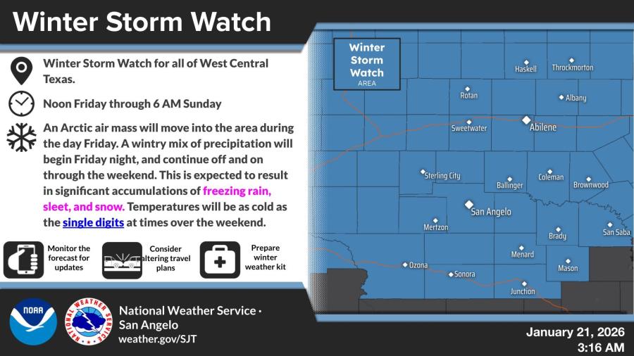
SAN ANGELO, TX — The National Weather Service has issued a Winter Storm Watch for all of West Central Texas, warning of significant freezing rain, sleet and snow accumulations along with dangerously cold temperatures this weekend.
The watch is in effect from noon Friday through 6 a.m. Sunday, as an Arctic air mass moves into the region, bringing a wintry mix of precipitation starting Friday night and continuing intermittently through the weekend.
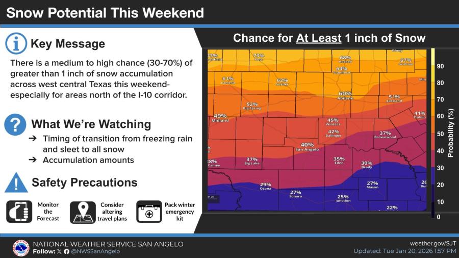
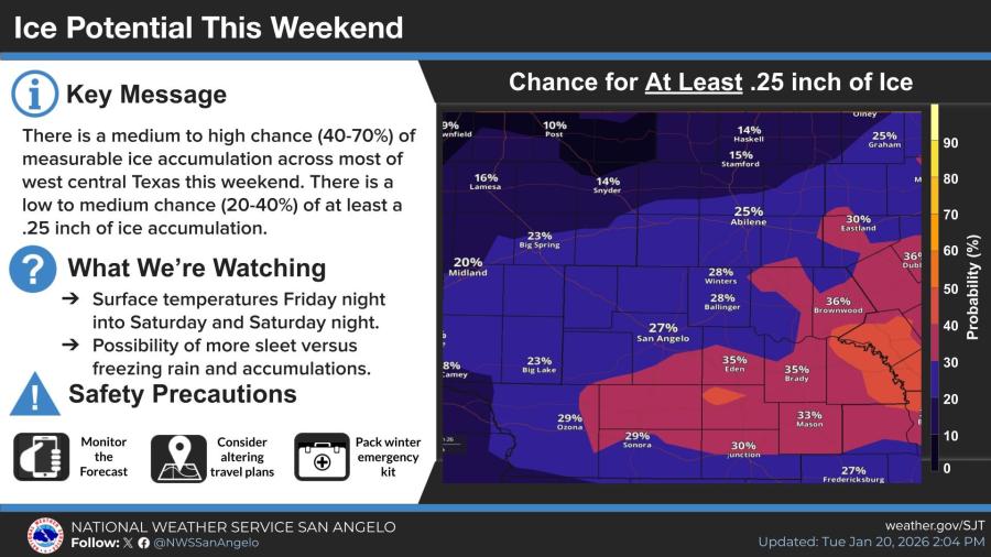
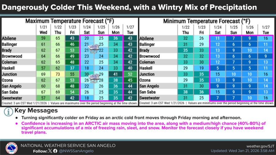
Forecasters said there is a medium to high chance (30%-70%) of at least 1 inch of snow, especially north of the Interstate 10 corridor, and a medium to high chance (40%-70%) of measurable ice accumulation. A low to medium chance (20%-40%) exists for at least a quarter-inch of ice, particularly south of Interstate 20.
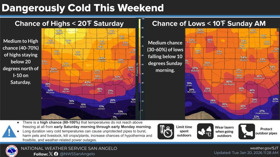
Temperatures are expected to remain below freezing from early Saturday morning through early Monday morning, with a medium to high chance of daytime highs staying below 20 degrees Saturday north of I-10 and a medium chance of morning lows dropping below 10 degrees Sunday.
In San Angelo, forecast highs fall from 68 degrees Thursday to 48 degrees Friday and 22 degrees Saturday before rebounding to 26 degrees on Sunday. Overnight lows are expected to dip into the single digits Saturday and Sunday nights.
The weather service urged residents to monitor updates, prepare winter emergency kits, limit time outdoors, protect pipes and safeguard pets and livestock. Travel could become hazardous due to icy roads and reduced visibility.


Subscribe to the LIVE! Daily

Required
Post a comment to this article here: