
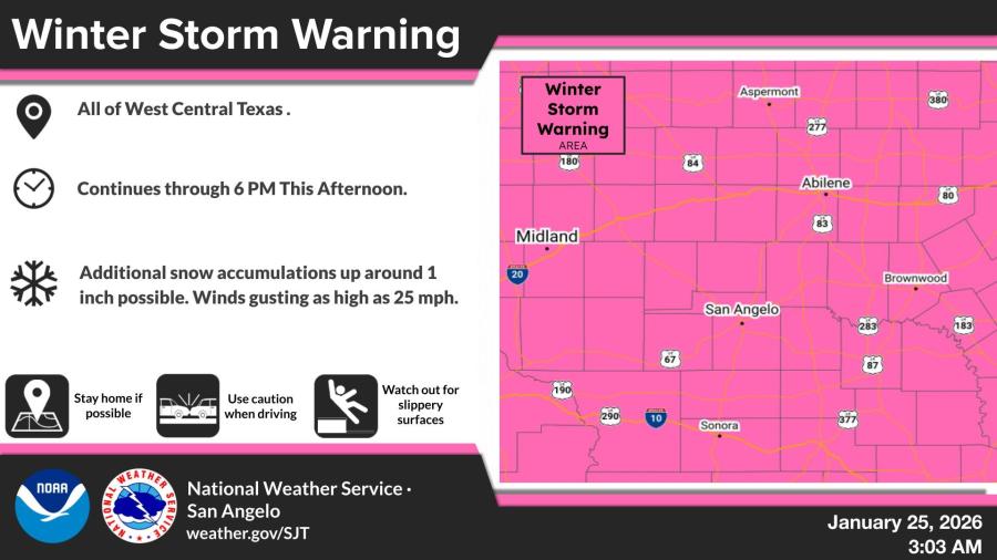
SAN ANGELO, TX — A Winter Storm Warning remains in effect for all of West Central Texas until 6 p.m. Sunday, with additional light snow accumulations of up to 1 inch possible and wind gusts reaching 25 mph, the National Weather Service in San Angelo reported.
The warning, issued early Sunday, covers areas including San Angelo, Abilene, Midland, and Brownwood. Forecasters said slippery surfaces and reduced visibility could make travel hazardous, urging residents to stay home if possible and use caution if driving.
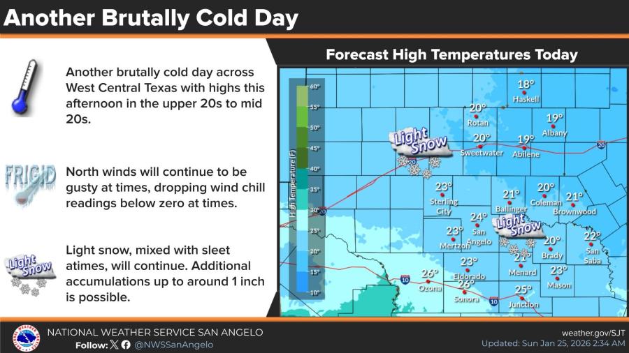
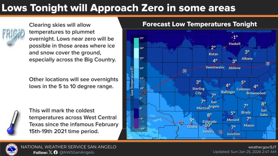
Brutally cold conditions persist across the region on Sunday, with afternoon highs struggling to reach the upper teens to mid-20s. Wind chills are expected to drop below zero at times due to gusty north winds. Overnight lows will approach zero in parts of the Big Country, with most other areas seeing readings in the 5 to 10 degree range — marking some of the coldest temperatures since the February 2021 winter storm.
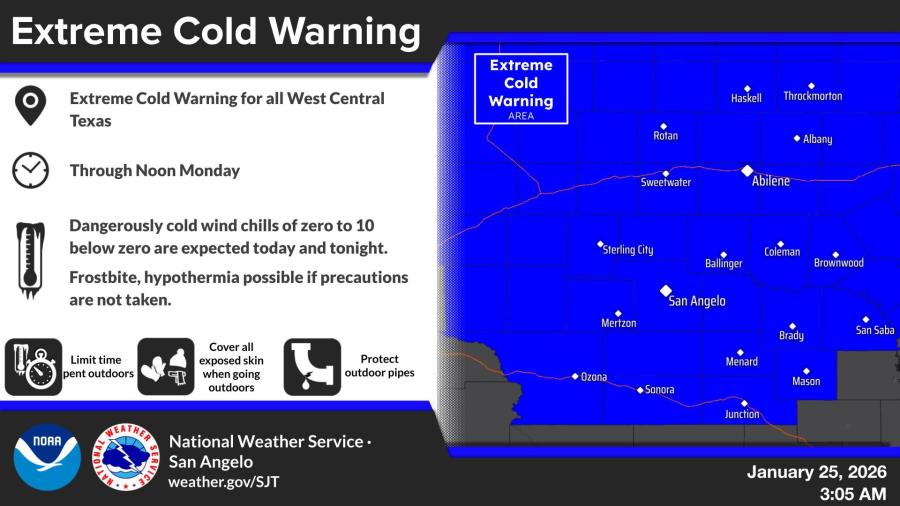
An Extreme Cold Warning is also in effect through noon Monday, with dangerously low wind chills of zero to 10 below zero forecast. Frostbite and hypothermia are possible without proper precautions, including limiting time outdoors, covering exposed skin, and protecting pipes.
In San Angelo, Sunday’s forecast calls for a 20% chance of snow showers before 3 p.m., partly sunny skies, and a high near 24°F. Winds from the north-northwest will blow 10-15 mph, with gusts to 25 mph and wind chills between -1°F and 9°F.
Sunday night will be mostly clear with a low around 7°F and wind chills between -4°F and 1°F. The cold eases slightly early next week, with highs climbing to near 29°F on Monday and the mid-40s by Tuesday and Wednesday under mostly sunny skies.


Subscribe to the LIVE! Daily

Required
Post a comment to this article here: