
SAN ANGELO, TX — Scattered showers are expected to develop across West Central Texas from late Tuesday into Thursday morning, the National Weather Service in San Angelo forecast Thursday.
Rainfall amounts will remain light, with temperatures staying above freezing and little potential for wintry precipitation. The highest probabilities — generally 30-35% — are forecast for Wednesday in areas including Brady, San Saba, and Junction. Abilene and San Angelo could see chances peaking around 30-35%.
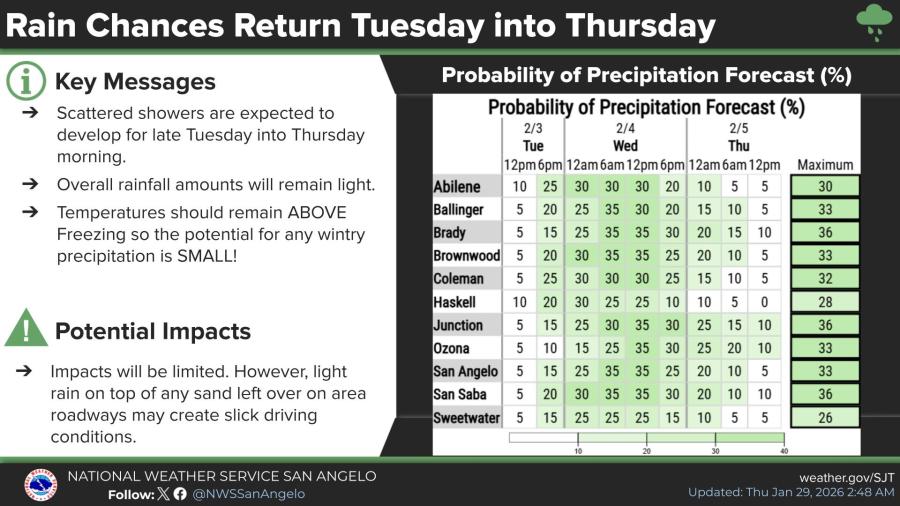
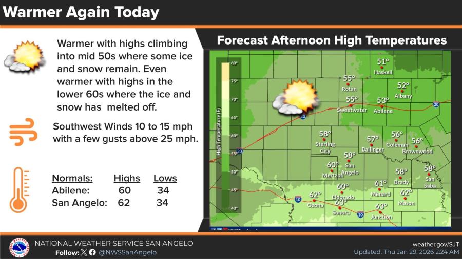
Light rain falling on any lingering sand on roadways may create slick driving conditions, forecasters warned, though overall impacts are expected to be limited. Dry conditions will prevail through the weekend following a warmer Thursday, when highs climb into the mid-50s, where ice and snow remain, and the lower 60s, where surfaces have melted.
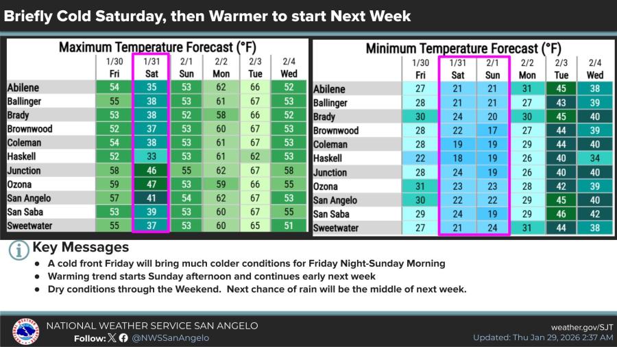
A cold front arriving Friday will drop temperatures sharply for Friday night through Sunday morning. Saturday highs will range from the mid- to upper 30s, with San Angelo at 41 degrees, San Saba at 39 degrees, and Sweetwater at 37 degrees. Overnight lows will fall into the upper teens to low 20s.
Warming begins Sunday afternoon and continues into early next week, pushing highs back into the 50s and 60s ahead of the rain chances.


Subscribe to the LIVE! Daily

Required
Post a comment to this article here: