
SAN ANGELO, TX — A marginal risk of severe thunderstorms is forecast across portions of West Central Texas from Friday afternoon through Saturday, with potential for large hail, strong winds, frequent lightning and moderate to heavy rainfall, the National Weather Service in San Angelo said.
The storms will be supported by an approaching upper-level disturbance and cold frontal boundary passing through the region Friday into Saturday. Areas shaded in dark green on NWS maps face the highest risk.
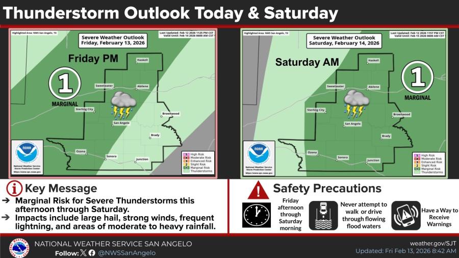
Forecasters emphasized safety precautions, urging residents never to drive or walk through floodwaters and to have multiple ways to receive weather warnings.
Much-needed rainfall is expected across the region this weekend, though not at drought-busting levels. Most likely totals range from one-third to three-quarters of an inch, with timing from Friday afternoon through Saturday evening and peak activity Saturday morning.
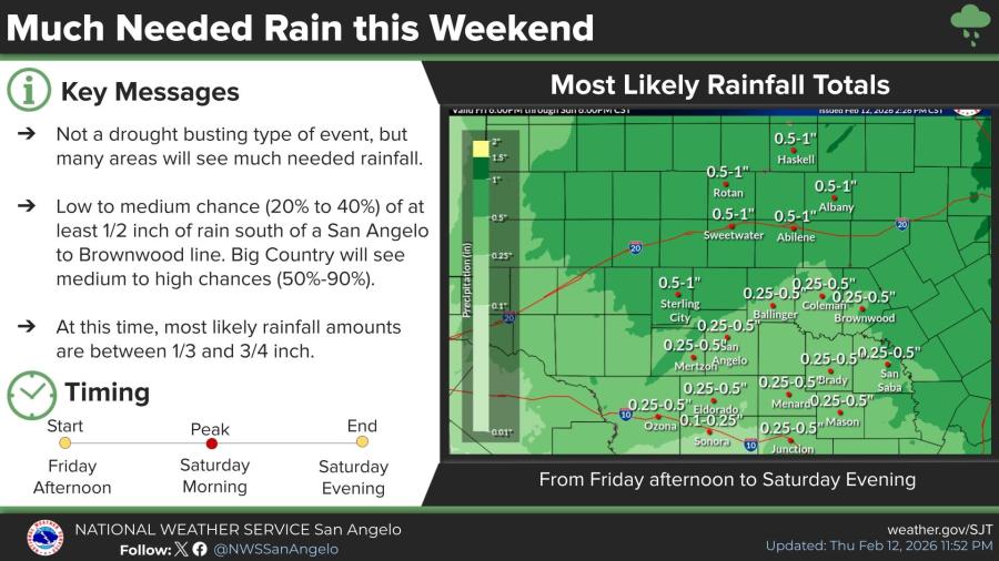
Chances of at least half an inch of rain are 20% to 40% south of a line from San Angelo to Brownwood, rising to 50% to 90% across the Big Country.
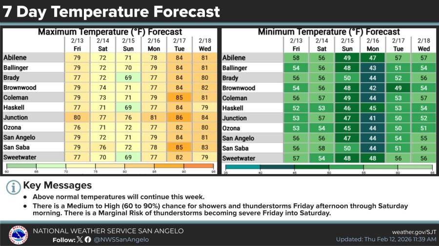
Above-normal temperatures will continue through next week. Friday highs in the San Angelo area are forecast around 79 degrees, dropping to the low to mid-70s Saturday and Sunday before climbing into the upper 70s and 80s early next week. Overnight lows will remain well above freezing, generally in the 40s and 50s.


Subscribe to the LIVE! Daily

Required
Post a comment to this article here: