
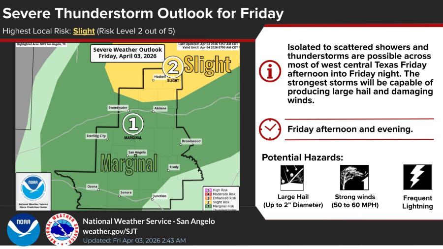
SAN ANGELO, TX — Strong to severe thunderstorms capable of large hail and damaging winds are possible across much of West Central Texas this afternoon into Friday night, the National Weather Service said.
The NWS office in San Angelo placed much of the region under a Slight risk for severe thunderstorms — risk level 2 of 5 — with a Marginal risk in the San Angelo area. Isolated to scattered showers and thunderstorms are expected to develop by early afternoon Friday, April 3, 2026, with coverage increasing through the evening. The strongest storms could produce hail up to 2 inches in diameter, wind gusts of 50 to 60 mph and frequent lightning.
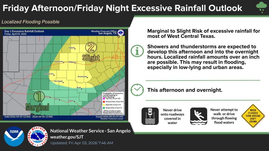
A marginal to slight risk of excessive rainfall also exists for most of West Central Texas. Localized amounts exceeding 1 inch are possible, which could lead to flooding in low-lying and urban areas. The highest flooding risk is north of a line from San Angelo to Brady.
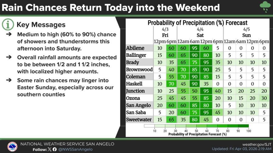
Rain chances will remain elevated at 60% to 90% from Friday afternoon into Saturday. Overall rainfall is forecast at one-half to 1 1/2 inches, with some localized higher amounts. A few showers and thunderstorms may linger into Easter Sunday, especially across southern counties.
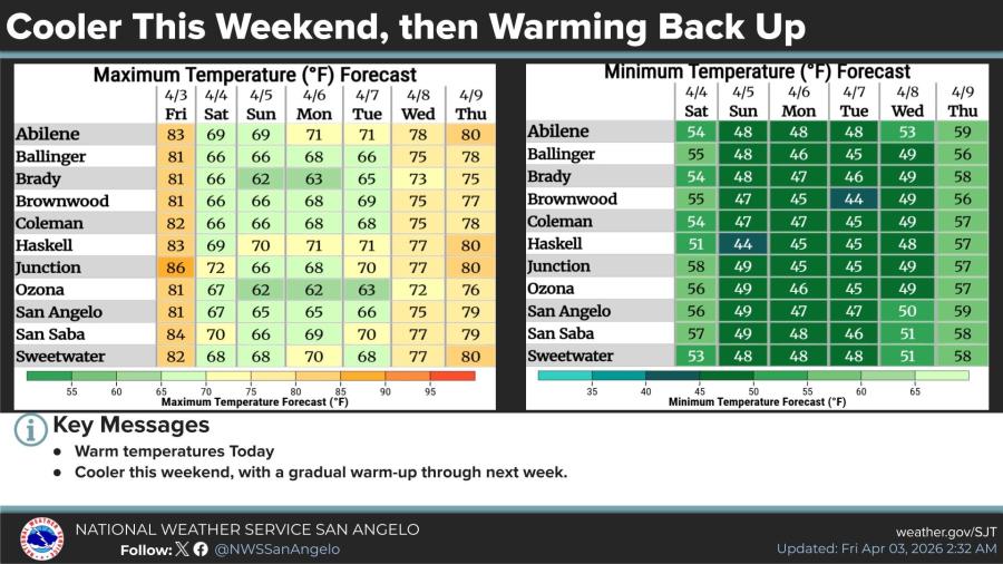
Temperatures will turn cooler this weekend after warm highs in the low to mid-80s Friday. Daytime highs are expected in the mid-60s to low 70s Saturday and Sunday, with overnight lows dropping into the mid-40s to low 50s. A gradual warm-up is forecast early next week.


")
Subscribe to the LIVE! Daily

Required
Post a comment to this article here: