
SAN ANGELO, TX — San Angelo and the Concho Valley face a very low risk of damaging winds and hail Friday as the National Weather Service forecasts only isolated thunderstorms with limited coverage and intensity.
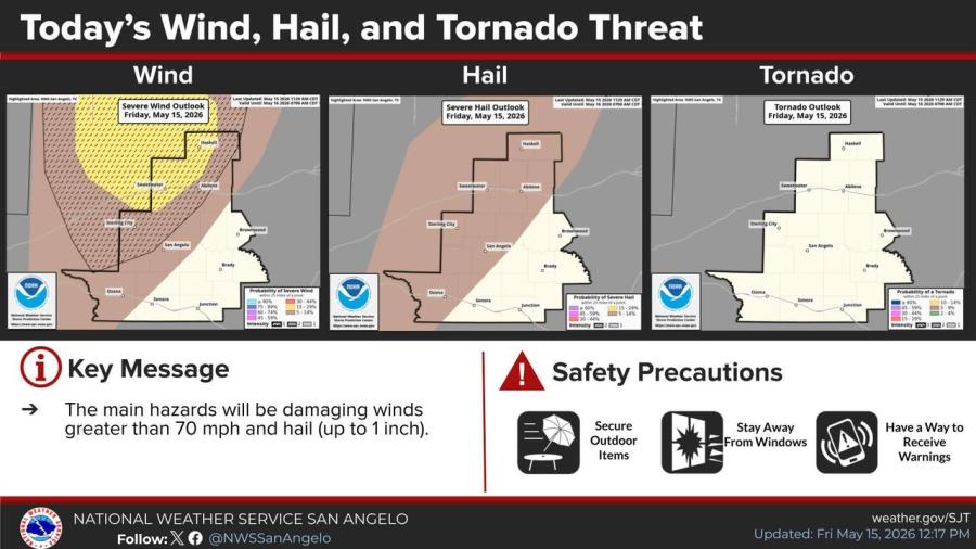
The NWS has placed the western Big Country under a Slight Risk (Level 2 out of 5) for severe thunderstorms, with the highest coverage expected there. Storms in that area could produce damaging wind gusts over 70 mph and hail up to the size of quarters.
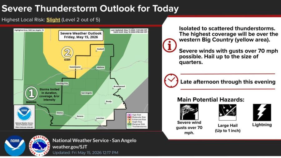
Farther south in the Concho Valley, including San Angelo, storms are expected to be less numerous and less severe, though some damaging winds and small hail remain possible.
Storms, if they develop, are most likely late afternoon through this evening. The main hazards across the region are damaging winds greater than 70 mph and hail up to 1 inch. The tornado threat is low.
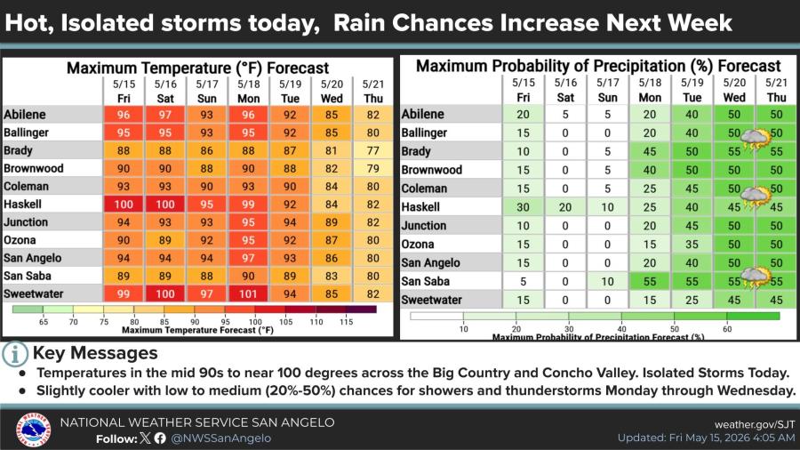
High temperatures will reach the mid-90s in San Angelo on Friday, with hotter conditions farther north and west, where some spots could approach or exceed 100 degrees.
Hot and mainly dry conditions are forecast through the weekend. Rain chances increase to low-to-medium levels (20% to 55%) Monday through Wednesday with slightly cooler temperatures.
Residents in the western Big Country should secure outdoor items, stay away from windows during storms and have multiple ways to receive warnings


")
Subscribe to the LIVE! Daily

Required
Post a comment to this article here: