

SAN ANGELO, TX — Isolated to scattered showers and thunderstorms are expected Saturday across West Central Texas near a weak, southward-moving cold front, the National Weather Service said.
The storms are not expected to be severe but could produce lightning, gusty winds and brief heavy rainfall, typical of summer thunderstorms in the region. Cloud cover associated with the front should keep afternoon highs in the mid- and upper 90s, cooler than recent days.
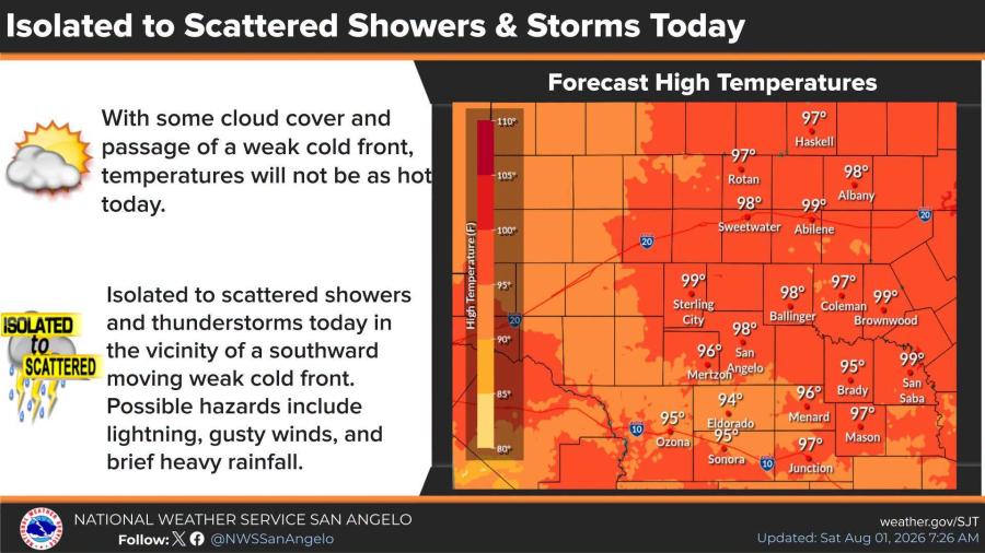
Forecast highs include 99 degrees in Abilene, 98 in Sweetwater, 97 in Haskell, Coleman and Junction, 98 in San Angelo and 95 in Brady and Ozona.
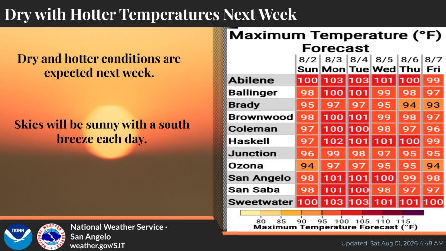
Dry and hotter weather is forecast for next week, with sunny skies and a south breeze each day. Highs are expected to climb into the triple digits in many areas, including 100 to 103 in Abilene and Sweetwater early in the week before settling near 100 by Friday.
You can view current radar by clicking HERE.

Subscribe to the LIVE! Daily

Required
Post a comment to this article here: