

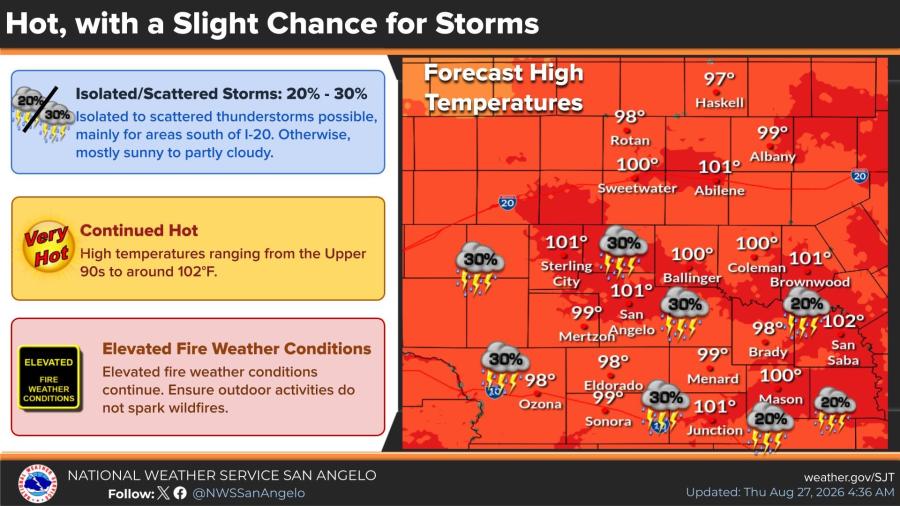
SAN ANGELO, TX — Isolated to scattered thunderstorms are possible Thursday afternoon and evening mainly south of Interstate 20, the National Weather Service in San Angelo said, while high temperatures remain in the upper 90s to around 102 degrees.
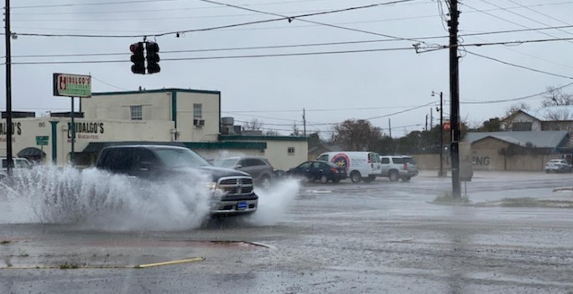
A few strong storms could produce gusty winds and lightning, the main concerns, along with brief locally heavy rain. An isolated damaging wind gust is possible south of Interstate 10. The highest local risk is marginal. Storm chances are 20% to 30% in some areas south of I-20; otherwise skies will be mostly sunny to partly cloudy.
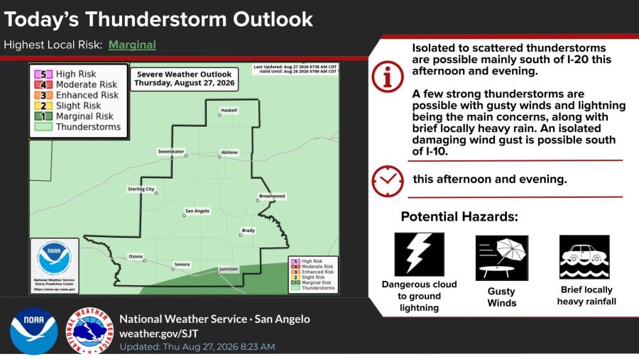
Hazards include dangerous cloud-to-ground lightning, gusty winds and brief heavy rainfall.
Hot weather is expected to continue through early September, with highs ranging from the upper 90s to around 103 degrees. Thursday’s forecast highs include 100 degrees in Abilene and San Angelo, 101 in San Saba, 99 in Sweetwater and 97 in Brady.
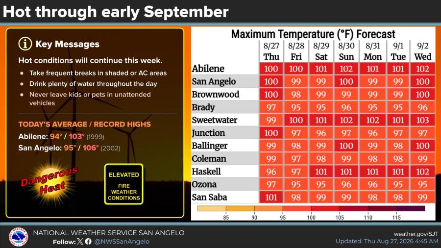
Average highs for the date are 94 in Abilene and 95 in San Angelo. Record highs are 103, set in Abilene in 1999, and 106, set in San Angelo in 2002.
Elevated fire weather conditions continue. The NWS urged residents to take frequent breaks in shade or air conditioning, drink plenty of water and never leave children or pets in unattended vehicles. Outdoor activities should not spark wildfires.
Subscribe to the LIVE! Daily

Required
Post a comment to this article here: