

SAN ANGELO, TX — Light to occasionally moderate rain continues across southeastern portions of the region this morning, mainly south of a Sonora-to-Brady-to-San Saba line, with more hit-or-miss activity in the Concho Valley, the National Weather Service reported.
In a 7:45 a.m. Monday update, the NWS Abilene/San Angelo office stated the general trend is expected to continue into the afternoon hours before rain starts to dissipate by the end of Monday morning. Warmer and drier conditions are then forecast to return later this week.
Small rises are occurring on some rivers, specifically along the Llano and San Saba rivers. These rises are not expected to reach flood stage, but low-water crossings may become flooded and impassable. The NWS advised motorists not to attempt to cross areas where water covers the road.
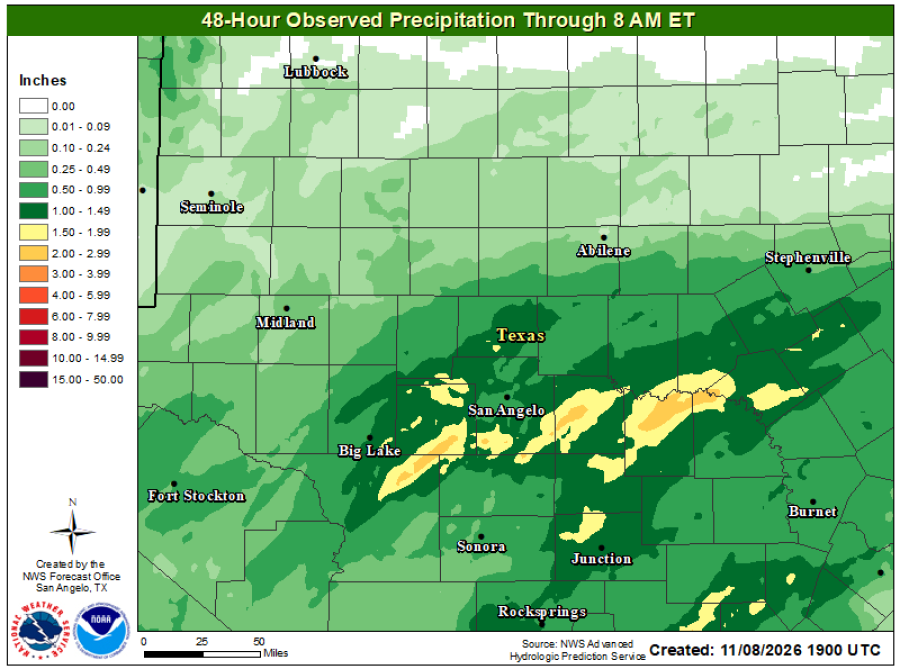
A 48-hour observed precipitation map showed the heaviest totals — roughly 1.5 to nearly 2 inches in yellow-shaded areas — concentrated near San Angelo, Big Lake and eastward stretches, with lighter amounts farther north and west.
The NWS San Angelo extended forecast, updated at 5:55 a.m. Monday, lists Monday precipitation probabilities as high as 90% in Junction, 75% in Ozona and San Angelo, 70% in Brady, 60% in San Saba and 50% in Ballinger. Chances drop to near zero midweek before rising again into the 30-40% range by Sunday in several locations.
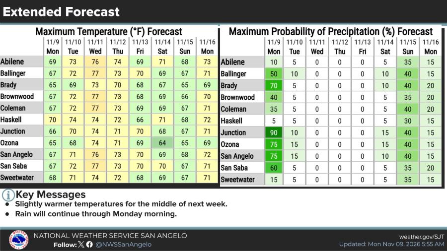
High temperatures are forecast in the mid-60s to low-70s Monday, rising into the mid- to upper-70s midweek (peaking around 74-77 degrees in many spots Wednesday), then easing slightly.

Subscribe to the LIVE! Daily

Required
Post a comment to this article here: