
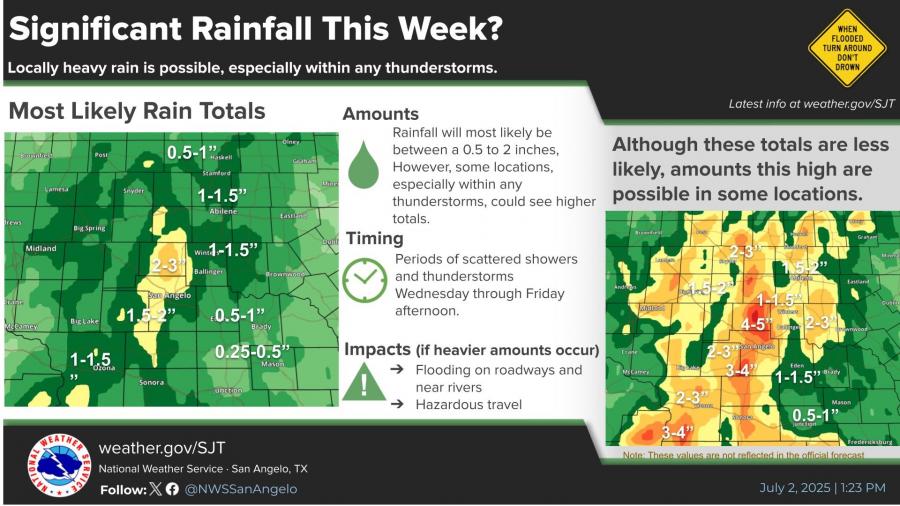
SAN ANGELO, TX — Periods of heavy rain are forecast to continue across West Central Texas through Friday, with some areas potentially receiving more than 2 inches of rainfall, raising concerns over flooding in low-lying areas and along roadways, according to the National Weather Service in San Angelo.
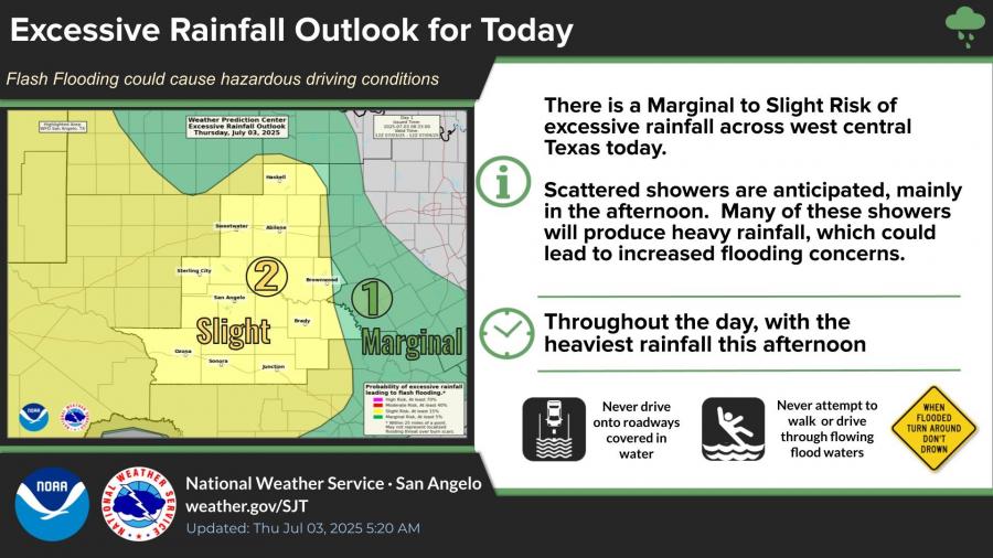
A Marginal to Slight Risk of excessive rainfall exists today, with scattered showers expected mainly in the afternoon. The heaviest rainfall is anticipated later today, which could cause flash flooding and hazardous driving conditions.
Rainfall totals through Friday are most likely to range between 0.5 to 2 inches, though localized amounts exceeding 3 inches are possible within stronger thunderstorms. Flooding impacts could include hazardous travel and rising waters near rivers.
Despite the wet conditions, temperatures are forecast to remain below normal through the weekend, with highs mostly in the upper 80s to low 90s. A drying trend is expected to begin over the weekend, with temperatures climbing back into the upper 90s and near 100 degrees by the middle of next week.
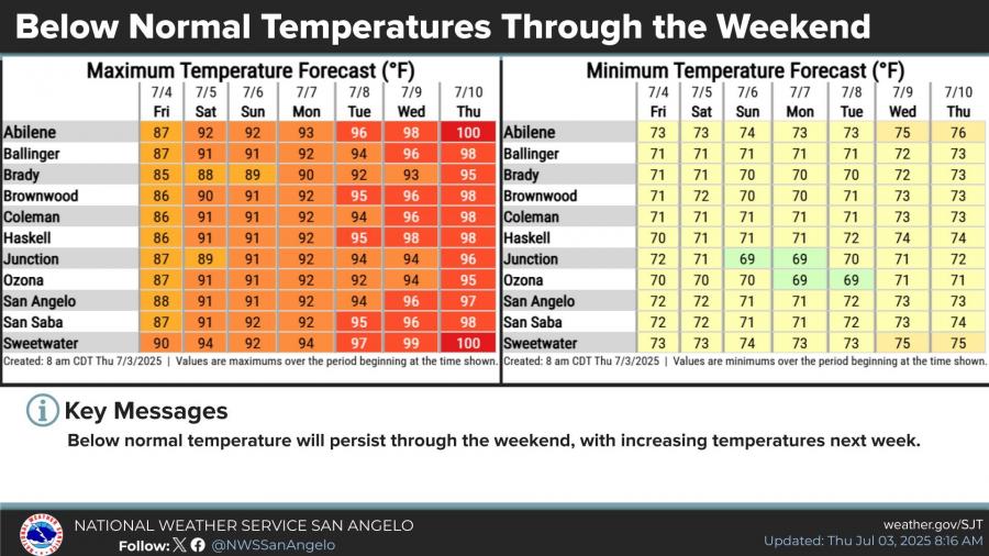
The detailed forecast for San Angelo calls for a 50 percent chance of showers and thunderstorms on Independence Day, with highs near 88 degrees. Rain chances decrease into the weekend, with partly sunny skies and highs near 91 degrees on Saturday and Sunday.
The National Weather Service advises drivers to avoid flooded roads and to never attempt to drive through flowing floodwaters.
")


Subscribe to the LIVE! Daily

Required
Post a comment to this article here: