
SAN ANGELO, TX — Strong to severe thunderstorms are expected to develop north of the Concho Valley on Sunday afternoon and move south into the area Sunday night into early Monday morning, according to the National Weather Service in San Angelo.
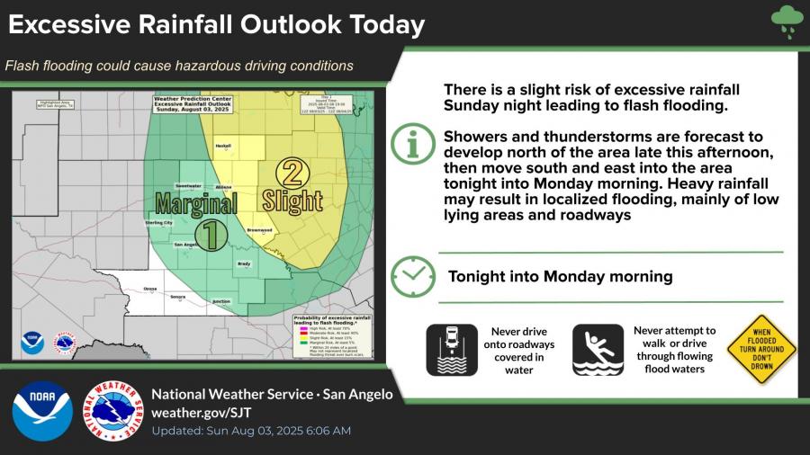
Forecasters say the main threats will be large hail and damaging winds, with a tornado also possible. Locally heavy rainfall could lead to flash flooding, particularly in low-lying areas and roadways.
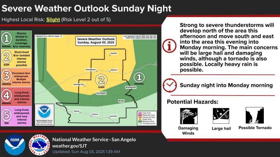
The Storm Prediction Center has placed San Angelo and surrounding areas under a marginal risk for severe weather, with the highest impacts expected overnight into Monday morning. A slight risk of excessive rainfall has also been issued for much of West Central Texas.
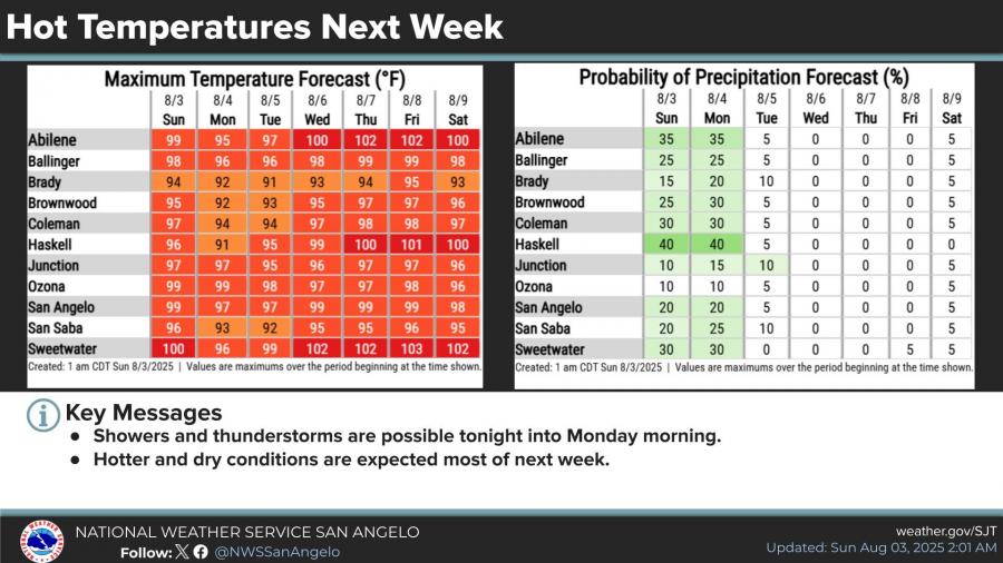
Rain chances will decrease after Monday, with hotter and drier conditions expected through the rest of the week. High temperatures in San Angelo are expected to remain in the upper 90s, reaching near 100 degrees through much of the upcoming week.
The National Weather Service issued a Flood Advisory for the north and northwest sides of San Angelo on Saturday night after more than an inch of rain fell in a short period. The advisory, effective until 9:45 p.m., came as showers lingered in the area and street flooding was reported near North Chadbourne Street and Grape Creek Road. Forecasters said showers in the area were expected to dissipate between 8 and 9 p.m.
")


Subscribe to the LIVE! Daily

Required
Post a comment to this article here: