
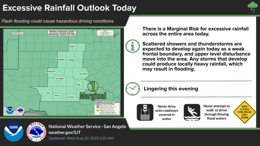
SAN ANGELO, TX — Scattered showers and thunderstorms are expected across the Concho Valley today, with the potential for locally heavy rainfall that could cause flash flooding, according to the National Weather Service in San Angelo.
Forecasters released a marginal risk for excessive rainfall across the entire region Wednesday as a weak frontal boundary and upper-level disturbance move into West Central Texas. Any storms that develop could produce heavy downpours and gusty winds over 50 mph.
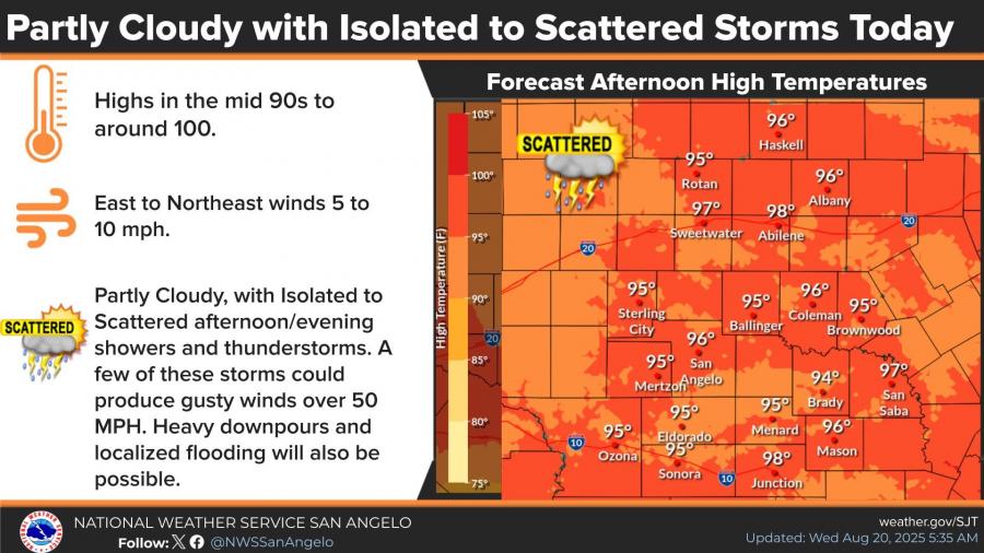
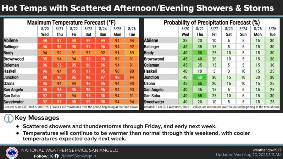
High temperatures are forecast to reach the mid-90s to near 100 degrees, with east to northeast winds around 5 to 10 mph. The hot weather is expected to continue into the weekend, though chances for afternoon and evening showers remain in place through Friday and early next week.
Rain chances are highest Wednesday and Thursday, with probabilities between 35 and 60 percent depending on location. Areas including Brady, Ozona, San Saba, and Junction have the greatest likelihood of storms. Chances decrease heading into the weekend but return early next week, paired with slightly cooler temperatures.
The National Weather Service advised motorists not to drive through flooded roads and urged residents to remain cautious of sudden downpours that may lead to flash flooding.
")


Subscribe to the LIVE! Daily

Required
Post a comment to this article here: