
SAN ANGELO, TX — Isolated to scattered showers and thunderstorms are expected across West Central Texas beginning Tuesday as a cold front moves through the region, according to the National Weather Service in San Angelo.
Forecasters said the system will bring increased rain chances Tuesday into Wednesday, with precipitation probabilities ranging from 30% to 42% in much of the area. Abilene is forecast for a 40% chance of rain, while San Angelo has about a 33% chance.
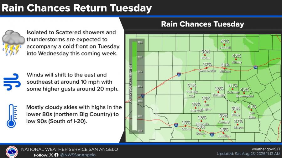
Winds are expected to shift to the east and southeast around 10 mph, with gusts near 20 mph. Mostly cloudy skies will accompany cooler conditions, with highs in the lower 80s in the northern Big Country and the low 90s south of Interstate 20.
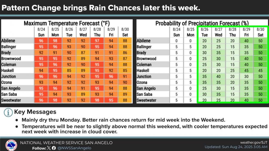
The region will remain mainly dry through Monday before rain chances return midweek, NWS said. Temperatures are expected to trend near or slightly above normal through the weekend before cooling as cloud cover increases. By Friday and Saturday, rain chances rise to 45–50% across much of the Concho Valley and Big Country.
")


Subscribe to the LIVE! Daily

Required
Post a comment to this article here: