
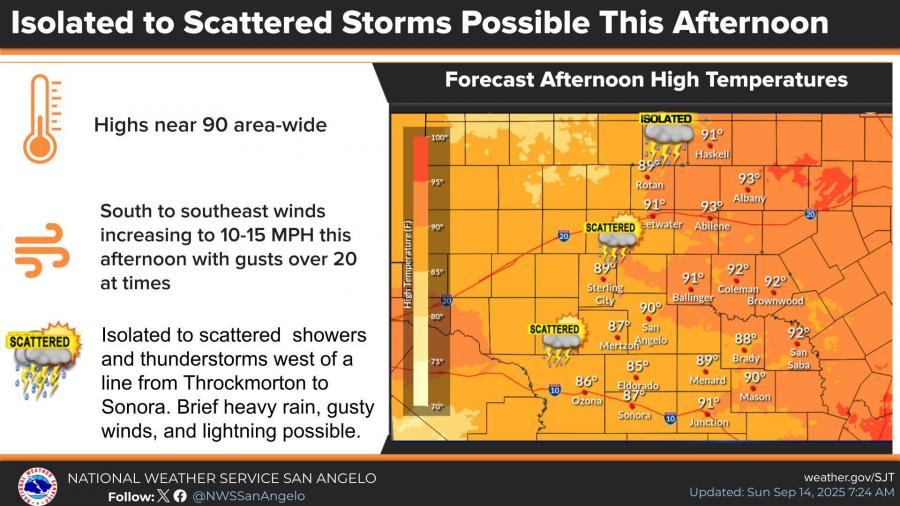
SAN ANGELO, TX — Isolated to scattered showers and thunderstorms are possible this afternoon and evening across western counties, according to the National Weather Service in San Angelo. The rest of the region can expect highs in the upper 80s to low 90s.
Forecasters said storms may develop west of a Throckmorton-to-Sonora line, bringing brief heavy rain, gusty winds, and lightning. South to southeast winds will increase to 10–15 mph this afternoon, with gusts topping 20 mph at times.
Looking ahead, temperatures will remain warm and generally above normal, with highs mainly in the 90s through Saturday. Rain chances decrease after today, with dry and hot conditions expected to dominate much of the upcoming week.
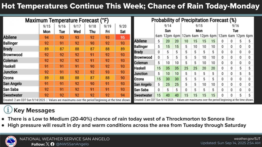
The extended outlook calls for mostly sunny skies Monday through Wednesday, with highs near 90 to 92 degrees. A slight chance of storms returns Thursday before dry conditions resume Friday and Saturday, when highs could reach the mid-90s.
")


Subscribe to the LIVE! Daily

Required
Post a comment to this article here: