
SAN ANGELO, TX — The National Weather Service in San Angelo is warning of the potential for heavy rainfall and strong thunderstorms across much of West Central Texas from Friday afternoon through early Saturday morning.
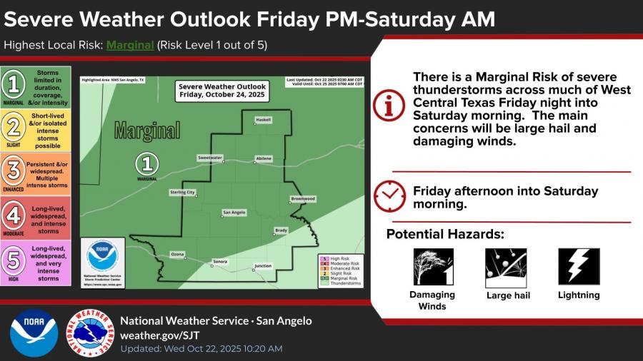
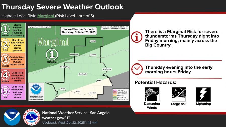
A Marginal to Slight Risk (levels 1–2 out of 5) for severe weather and excessive rainfall has been issued. Forecasters say the main threats will be damaging winds, large hail, and flash flooding caused by heavy downpours.
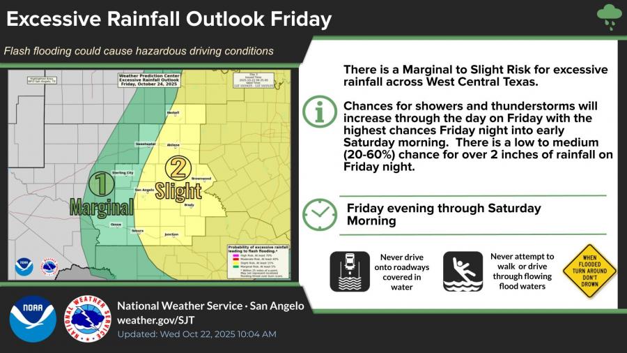
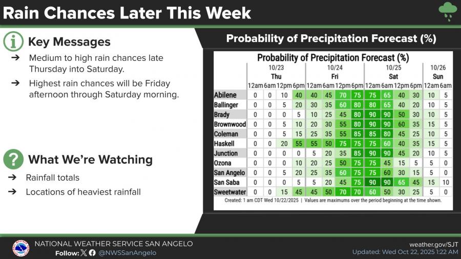
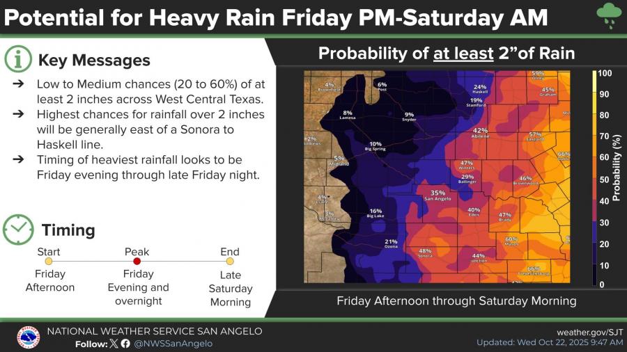
According to the NWS, the highest rain chances — between 70% and 90% — are expected from Friday afternoon through Saturday morning. Some areas could see 2 inches or more of rain, especially east of a Sonora-to-Haskell line.
A few strong storms are also possible Thursday night into early Friday, mainly north of San Angelo. Those storms could bring large hail and gusty winds before the main weather system arrives Friday.
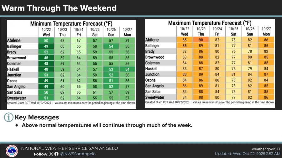
Temperatures will remain above normal through the week, with highs in the low to mid-80s before a cold front moves through on Saturday, bringing cooler air to the region.
")


Subscribe to the LIVE! Daily

Required
Post a comment to this article here: