
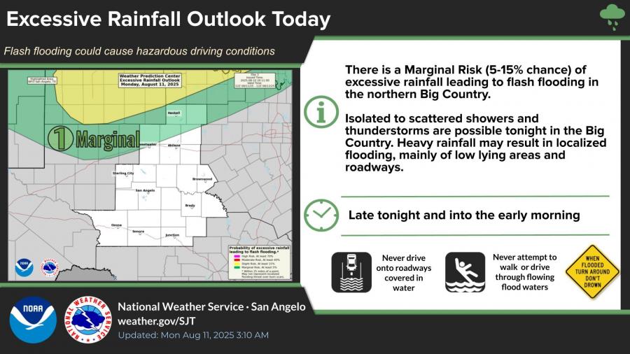
SAN ANGELO, TX — A slow-moving storm system is expected to bring scattered showers and thunderstorms to West Central Texas through Wednesday, according to the National Weather Service in San Angelo.
Forecasters say there is a marginal risk, or 5-15% chance, of excessive rainfall leading to flash flooding in the northern Big Country late Monday into early Tuesday. Heavy rainfall could result in localized flooding, mainly in low-lying areas and roadways.
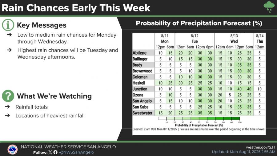
Rain chances will be highest Tuesday and Wednesday afternoons, with probabilities reaching up to 40% in some locations. The storms may produce dangerous lightning, gusty winds and brief heavy downpours.
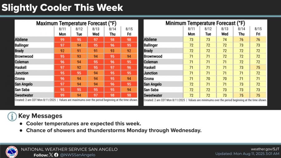
Temperatures are expected to be slightly cooler this week, with highs in the mid-90s to near 100 and lows in the low 70s.


Subscribe to the LIVE! Daily

Required
Post a comment to this article here: