
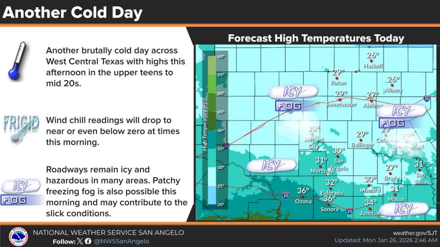
SAN ANGELO, TX — West Central Texas will endure another brutally cold day Monday with afternoon highs only in the upper teens to mid-20s and 30s, but a gradual warming trend is forecast to push temperatures into the 40s and 50s later this week, the National Weather Service said.
An Extreme Cold Warning remains in effect for the entire region until noon Monday. Dangerously low wind chills near or below zero are possible Monday morning, raising risks of frostbite and hypothermia. Forecasters urged residents to limit outdoor exposure, cover exposed skin and protect pipes.
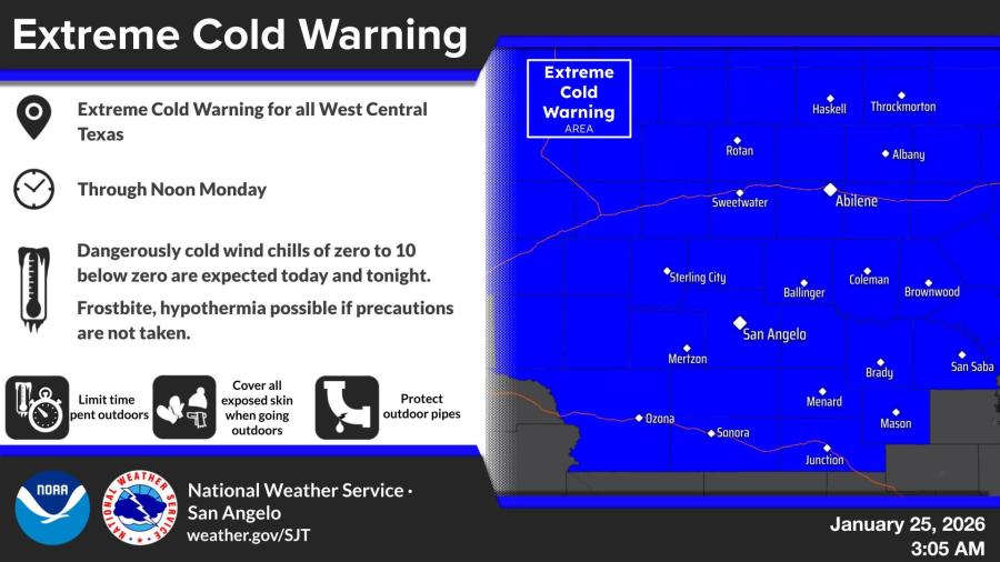
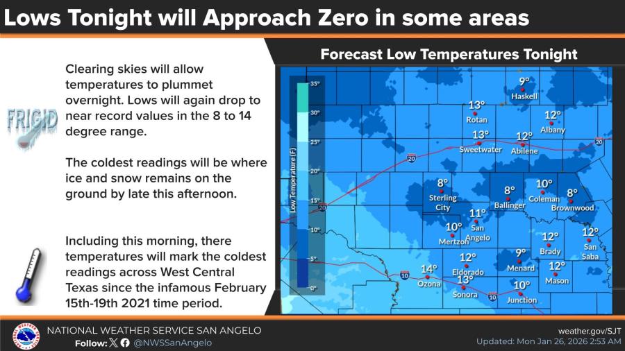
Road conditions remain hazardous with icy patches and possible freezing fog contributing to slick travel Monday morning. Overnight Monday, clearing skies will send lows plunging into the 8-14 degree range — the region’s coldest readings since the February 2021 arctic outbreak, particularly where snow and ice linger on the ground.
Relief arrives mid-week as an arctic air mass shifts eastward. Highs climb into the low to mid-40s Tuesday and Wednesday, reaching the upper 40s to mid-50s Thursday through the weekend. Morning lows will stay below freezing through much of the week but moderate into the 20s by next weekend. Dry conditions are expected to dominate.
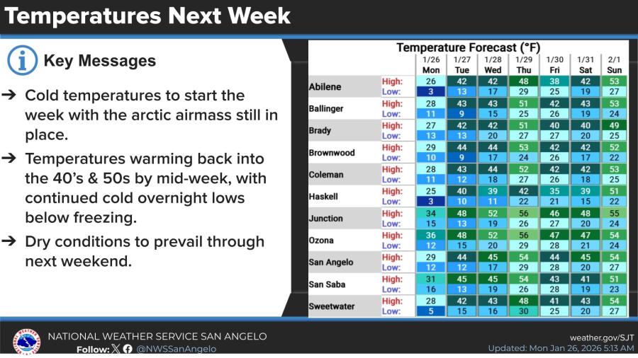
In San Angelo, Monday’s high is forecast near 29-31 degrees with a low around 12. Highs rise to 44-45 degrees Tuesday and Wednesday, then 54 degrees by Sunday, with lows gradually warming into the upper 20s. Similar patterns are expected in Abilene, Sweetwater, Brownwood, and Junction.


Subscribe to the LIVE! Daily

Required
Post a comment to this article here: