
SAN ANGELO, TX — Thunderstorms delivered heavy rain, small hail and gusty winds across West Central Texas early Saturday, with ongoing activity along a cold front expected to persist for a few more hours before storm chances continue through midweek.
The National Weather Service in San Angelo reported numerous showers and thunderstorms overspreading much of the area east of a line from Hamlin to Big Lake around 6 a.m., impacting San Angelo between 6:15 a.m. and 8:30 a.m. The storms brought lightning, moderate to heavy rain that could cause ponding on roads, and brief pea-sized hail in some areas. Gusty north winds followed behind the advancing cold front.
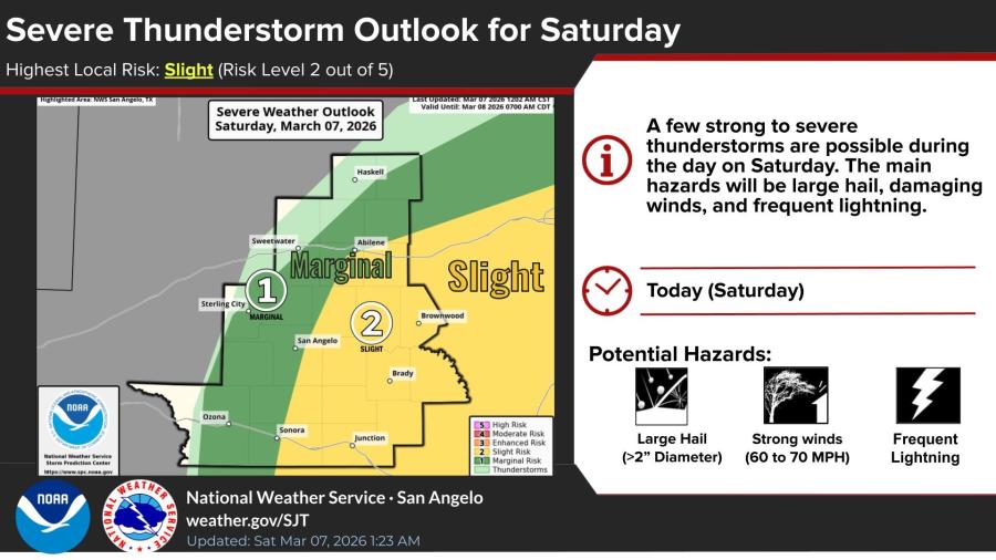
By mid-morning, thunderstorm development continued along the frontal boundary, with the potential for isolated 50-60 mph wind gusts and large hail remaining possible before the system pushes out of the region.
Multiple severe thunderstorm warnings were issued overnight and into the morning. A warning until 8 a.m. covered Coleman, Brown and Callahan counties, citing 1-inch hail and 60 mph winds. Earlier alerts included warnings for Clyde, Baird and Moran until 5:15 a.m. with gusts to 70 mph, Robert Lee, Sterling City and Edith until 4:30 a.m., and Water Valley until 3:45 a.m. No active warnings were in effect as of late morning.
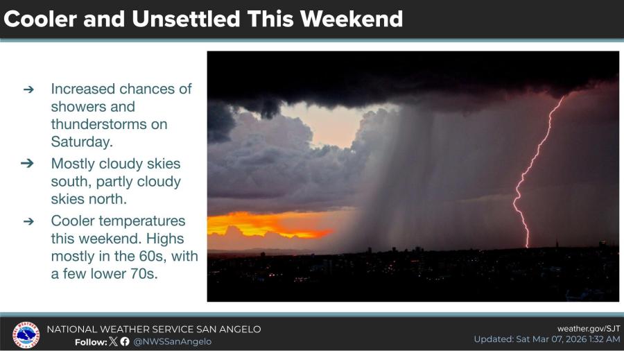
The weekend remains unsettled and cooler, with increased chances of showers and thunderstorms. Highs will mostly reach the 60s, with a few lower 70s possible. Skies are expected to be mostly cloudy in the south and partly cloudy in the north.
Today's forecast includes a 30% chance of showers and thunderstorms before 3 p.m., mostly cloudy with a high near 65. Northeast winds around 15 mph, gusting to 25 mph. Tonight, 20% chance of showers before 9 p.m., mostly cloudy with a low around 43 and northeast winds 5 to 15 mph.
Sunday: Chance of showers, thunderstorms possible after 3 p.m., partly sunny with a high near 68. North-northeast winds around 5 mph shifting southeast afternoon. Precipitation chance 30%. Sunday night: 20% chance of showers and thunderstorms before midnight, mostly cloudy with low around 54 and south winds around 5 mph.
Monday: 30% chance of showers after noon, mostly cloudy with high near 81. South-southwest winds 5 to 15 mph. Monday night: 40% chance of showers and thunderstorms, mostly cloudy with low around 61 and south winds 10 to 15 mph.
Tuesday: Showers likely, possible thunderstorm, mostly cloudy and breezy with high near 81. South-southwest winds 15 to 20 mph. Precipitation chance 60%, new rainfall a tenth to quarter inch, higher in thunderstorms. Tuesday night: Chance of showers and thunderstorms, partly cloudy with low around 53. West-southwest winds 10 to 15 mph gusting 20 mph. Precipitation chance 50%, new amounts quarter to half inch possible.
Wednesday: 20% chance of showers, sunny with high near 74. West-southwest winds 10 to 15 mph becoming north afternoon, gusts to 25 mph. Wednesday night: 20% chance of showers, mostly clear with low around 40. Northeast winds 5 to 15 mph gusting 20 mph.
Thursday: Sunny, high near 70. Thursday night: Clear, low around 44. Friday: Sunny, high near 83.


Subscribe to the LIVE! Daily

Required
Post a comment to this article here: