
SAN ANGELO, TX — Scattered to numerous showers and a few embedded thunderstorms will continue developing from south to north across West Central Texas on Monday, the National Weather Service in San Angelo stated.
Most of the rain is expected south of Interstate 20, with totals between one-half inch and 1.5 inches possible. Ponding of water on roads is likely in some spots.
As of Monday morning, National Weather Service radar showed widespread showers and thunderstorms across much of the region, including areas around San Angelo, Brownwood and points farther south.
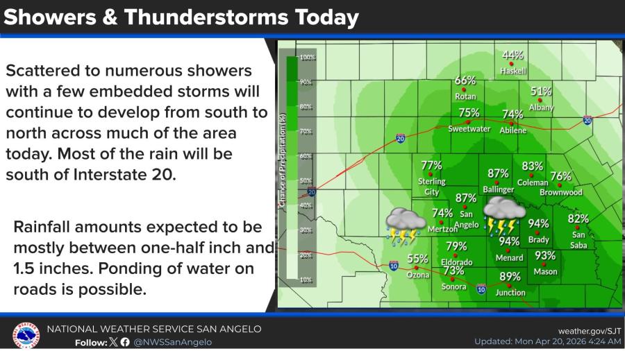
In San Angelo, the forecast calls for a high near 60 with a 90% chance of precipitation. Showers and possible thunderstorms are most likely before 4 p.m., followed by additional chances later in the day. Patchy fog is possible before noon. Winds will be from the east-southeast at 5 to 10 mph.
Tonight, a 40% chance of showers and thunderstorms continues under cloudy skies, with a low around 54.
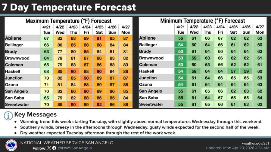
Dry weather returns Tuesday. A 20% chance of morning showers gives way to mostly cloudy skies and a high near 71. South-southeast winds will blow 5 to 10 mph.
Temperatures will warm steadily through the week under mostly sunny skies, reaching the mid-80s to low 90s by Thursday and Friday before settling back into the mid-80s over the weekend, the NWS said. Southerly winds will turn breezy to gusty at times.


Subscribe to the LIVE! Daily

Required
Post a comment to this article here: