
SAN ANGELO, TX — An isolated thunderstorm is possible late Sunday afternoon and early evening across central and eastern portions of the National Weather Service San Angelo forecast area, forecasters reported.
The National Weather Service has placed much of the region under a marginal risk — the lowest of its five levels — for severe thunderstorms Sunday. If a storm develops, it will likely become severe, with large hail up to golf ball size or larger and damaging winds of 60 mph or greater as the primary threats. Cloud-to-ground lightning is also expected. Storms are expected to be limited in duration, coverage and intensity.
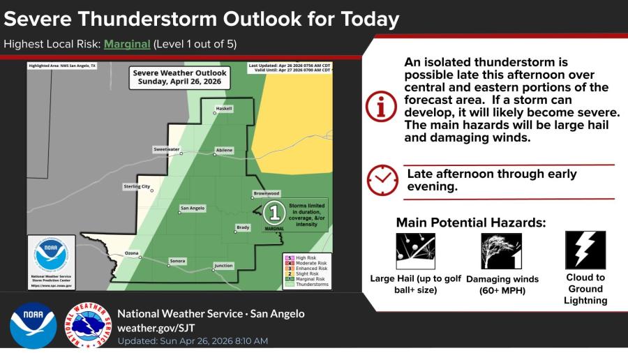
The threat is valid through early Monday morning.
Hot and mostly dry conditions will continue through Tuesday, with afternoon highs in the mid to upper 90s across the region. San Angelo is forecast to reach 96 degrees Sunday, 94 Monday and 95 Tuesday. Overnight lows will generally be in the upper 60s.
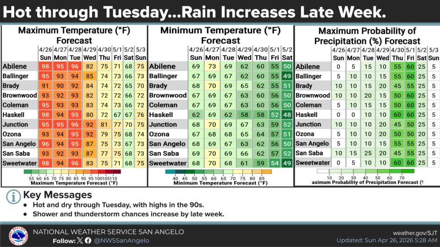
Chances for showers and thunderstorms will increase late in the week, with precipitation probabilities climbing to around 50-60% Thursday and Friday for many locations. Temperatures are expected to moderate slightly midweek ahead of the increased rain chances.


Subscribe to the LIVE! Daily

Required
Post a comment to this article here: