
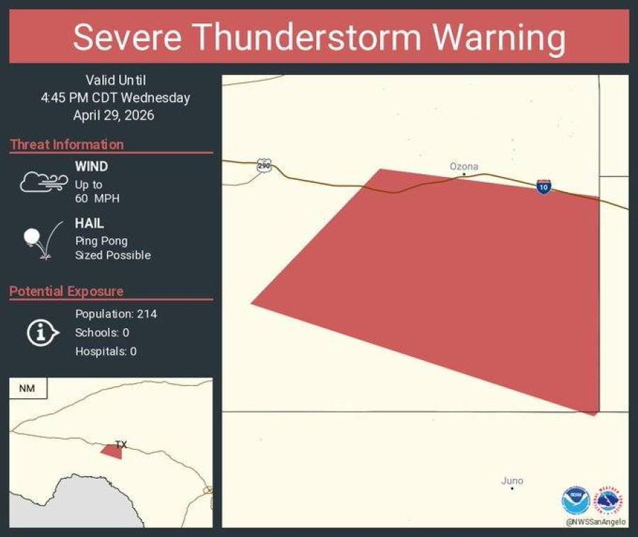
OZONA, TX — A severe thunderstorm warning was in effect Wednesday afternoon for a portion of Crockett County south of Ozona, where ping-pong ball-sized hail and wind gusts up to 60 mph were possible, the National Weather Service office in San Angelo said.
The warning covered an area along and south of Interstate 10 and was valid until 4:45 p.m. CDT, according to the NWS. Residents along Highway 163 from Ozona to the county line were urged to prepare for large hail. The storm was expected to affect a sparsely populated area of about 214 people, with no schools or hospitals in the warned zone.
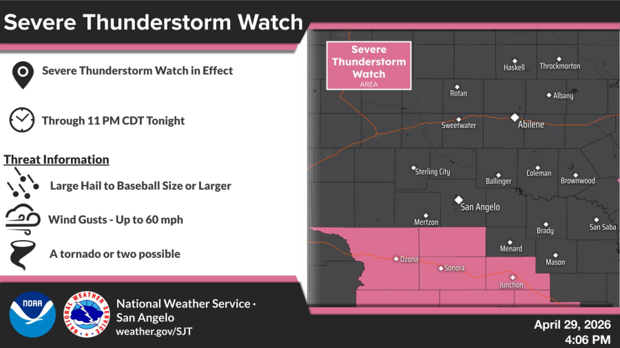
A broader severe thunderstorm watch remained in effect for much of the region south of the I-10 corridor through 11 p.m. CDT, the NWS said. That watch warned of large hail to baseball size or larger, wind gusts up to 60 mph and a possible tornado or two.


Subscribe to the LIVE! Daily

Required
Post a comment to this article here: