
SAN ANGELO, TX — An enhanced risk of severe thunderstorms will affect much of the San Angelo area Sunday afternoon and evening, the National Weather Service warned, with the main threats being very large hail and damaging winds.
The NWS San Angelo office placed the region under an Enhanced risk — level 3 out of 5 — for severe weather. Storms are expected to develop between 3 p.m. and 10 p.m. CDT, forecasters said.
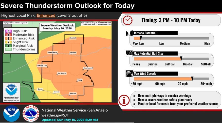
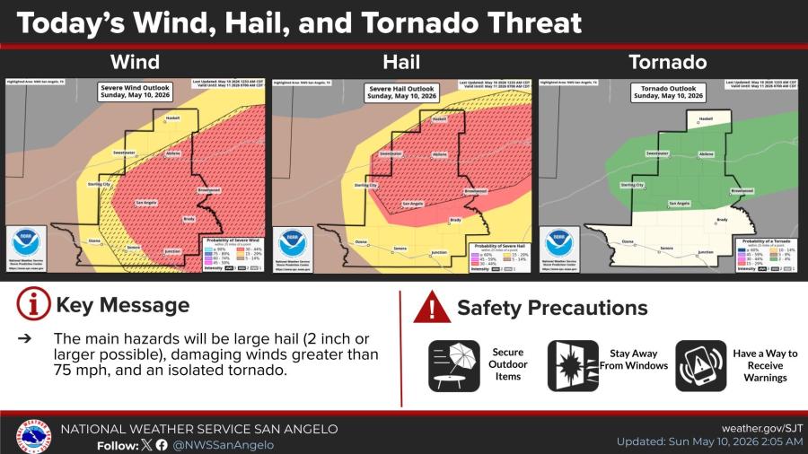
The primary hazards are hail 2 inches in diameter or larger, with some stones potentially reaching baseball size, and wind gusts exceeding 75 mph. An isolated tornado is possible but the probability remains very low, according to the outlook.
Probability maps issued Sunday showed the highest threat for severe wind and hail centered over a broad swath including Abilene, Brownwood, San Angelo, Sweetwater and surrounding counties. Forecasters urged residents to have multiple ways to receive warnings, secure outdoor items, stay away from windows and monitor local forecasts.
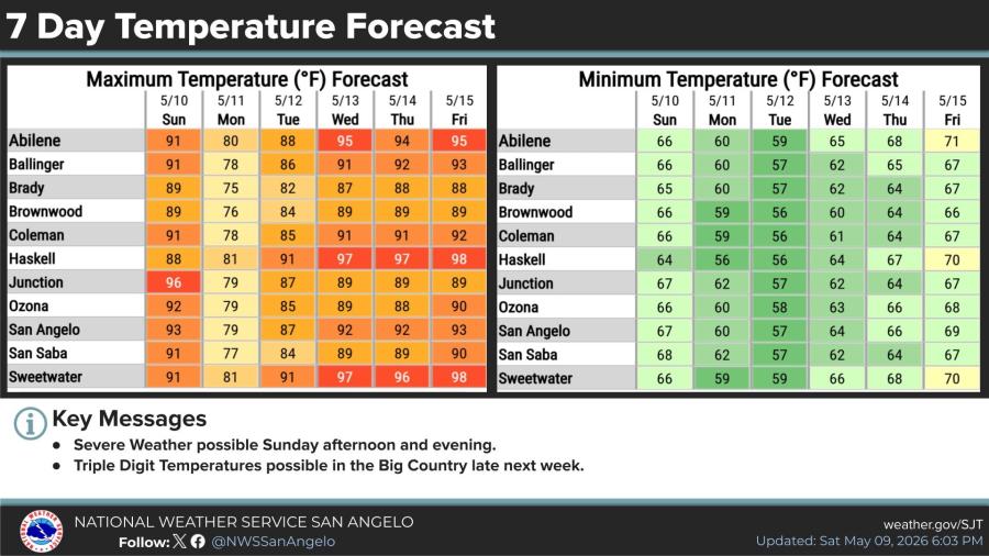
High temperatures Sunday are forecast to reach the low to mid-90s across the area, with Abilene at 91 degrees, San Angelo at 93 and Junction at 96. A cooler day is expected Monday, with highs mostly in the upper 70s, before temperatures climb again later in the week. Triple-digit highs are possible in the Big Country by late next week, the NWS said.


Subscribe to the LIVE! Daily

Required
Post a comment to this article here: