
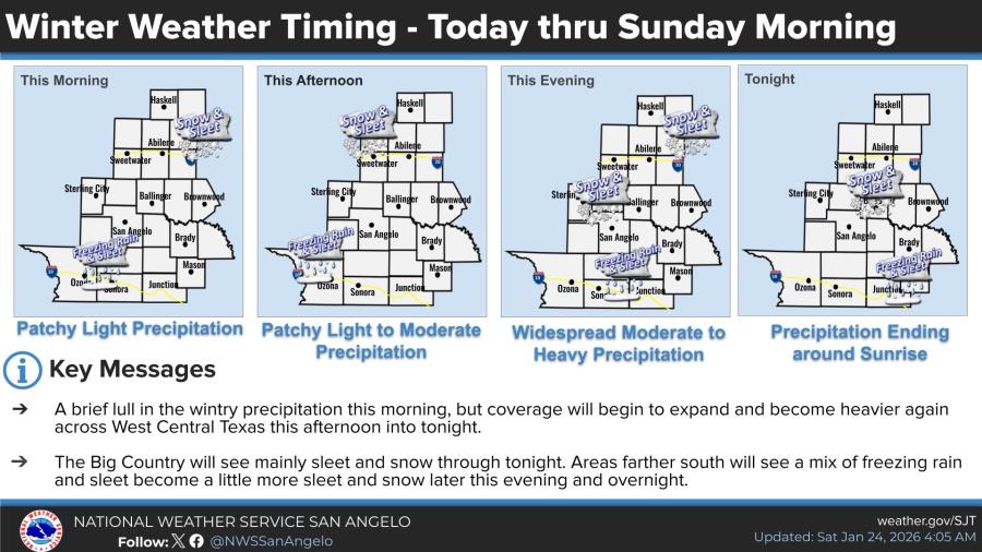
SAN ANGELO, TX — Wintry precipitation is expected to expand and intensify across West Central Texas this afternoon into tonight, with widespread moderate to heavy precipitation possible this evening before tapering off around sunrise Sunday, the National Weather Service said Saturday.
A brief lull in precipitation occurred Saturday morning after patchy light amounts overnight, but coverage will increase again this afternoon, according to NWS timing graphics. Northern areas of the Big Country are likely to see mainly sleet and snow tonight, while areas farther south will experience a mix of freezing rain and sleet.
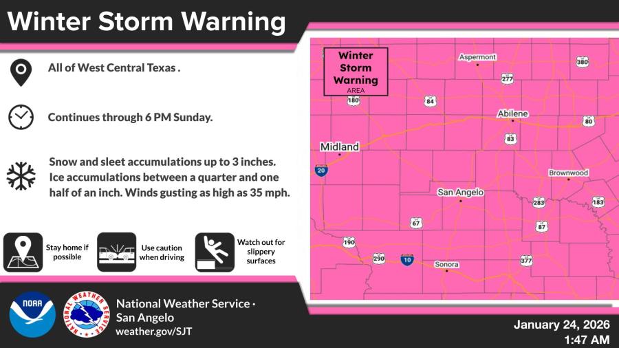
A Winter Storm Warning remains in effect for all of West Central Texas through 6 p.m. Sunday. Significant accumulations of freezing rain, sleet and snow are expected, with the event beginning Friday night and continuing through the weekend.
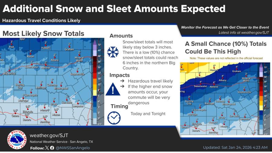
Snow and sleet totals will most likely stay below 3 inches, though there is a low (10%) chance of up to 6 inches in northern portions of the Big Country.
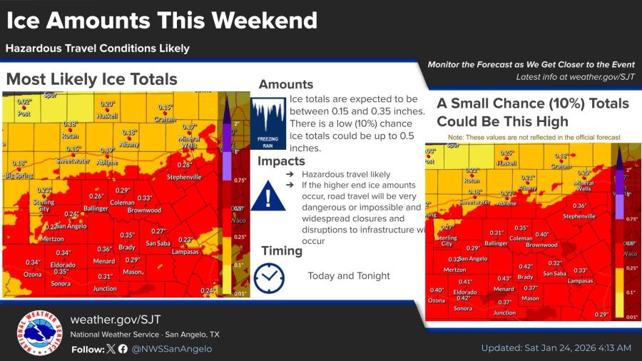
Ice accumulations are forecast between 0.15 and 0.35 inches, with a low (10%) chance of up to 0.5 inches. Hazardous travel conditions are likely today and tonight, with higher-end ice or snow amounts potentially making roads very dangerous or impassable.
An Extreme Cold Warning is also in effect for the entire region from 6 p.m. Saturday to noon Monday. Dangerously cold wind chills of zero to 10 degrees below zero are expected, raising the risk of frostbite and hypothermia if precautions are not taken.
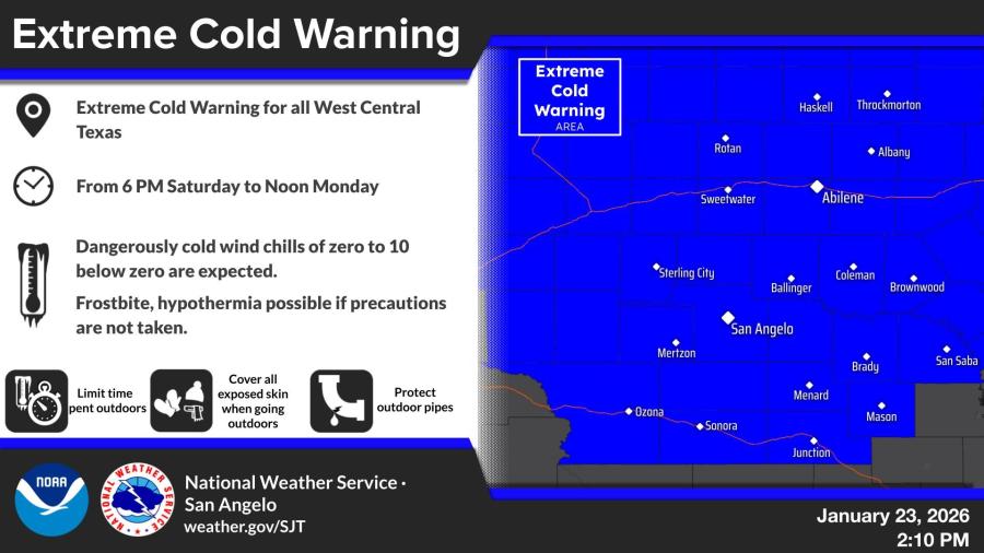
The National Weather Service in San Angelo urged residents to limit time outdoors, cover exposed skin, protect outdoor pipes and use caution if travel is necessary. Winds gusting as high as 35 mph are also possible through Sunday.
Find radar HERE.


Subscribe to the LIVE! Daily

Required
Post a comment to this article here: