
SAN ANGELO, TX — Much colder air settled into San Angelo and the Concho Valley on Monday following a cold front, with daytime highs in the mid-40s and overnight lows in the low to mid-30s, according to the National Weather Service.
Forecasters said a few flurries or light rain showers were possible Monday from Iraan to Mertzon to Sterling City and west of Sweetwater and Roby, though no accumulation was expected. Conditions otherwise remain dry.
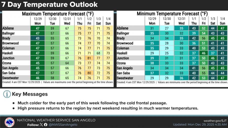
Temperatures are expected to gradually rebound through midweek. Highs in San Angelo are forecast to reach the upper 50s Tuesday and climb into the mid-60s by Wednesday.
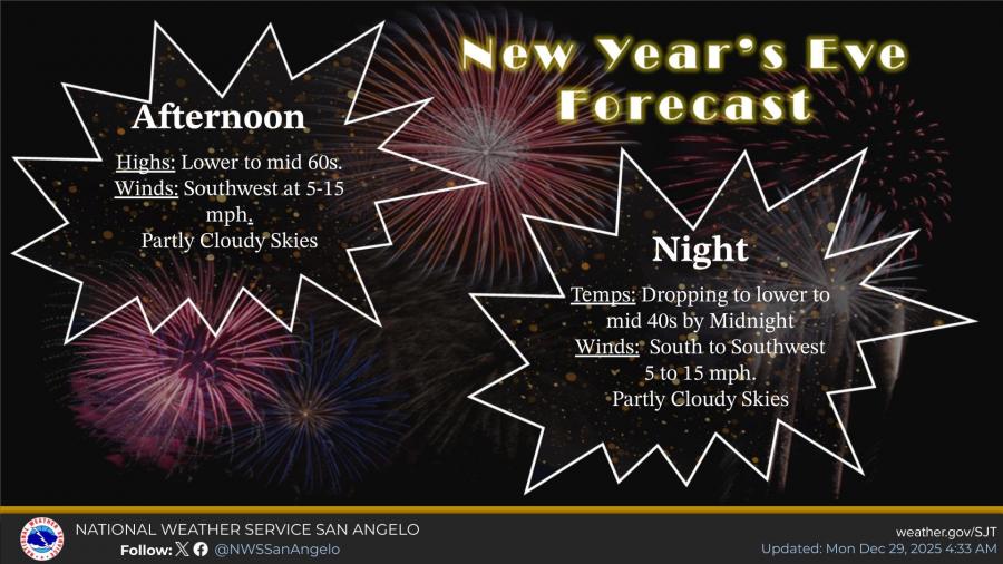
New Year’s Eve is expected to be mild, with afternoon highs in the lower to mid-60s and partly cloudy skies. Southwest winds of 5 to 15 mph are forecast during the day. Temperatures are expected to drop into the lower to mid-40s by midnight, with south to southwest winds continuing.
Warmer conditions are forecast to continue into the holiday weekend as high pressure returns to the region, pushing daytime highs into the 70s by Thursday and Friday, with overnight lows rising into the 50s.


Subscribe to the LIVE! Daily

Required
Post a comment to this article here: