
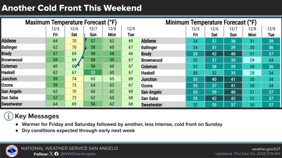
SAN ANGELO, TX — A warmer end to the workweek will be short-lived as another cold front is expected to move into West Central Texas on Sunday, according to the National Weather Service.
Forecasters said temperatures will rebound into the upper 60s and low 70s on Friday and Saturday before the next front arrives. Unlike the stronger system that dropped temperatures into the 40s on Thursday, this upcoming front is expected to be less intense, bringing highs back down into the 50s on Sunday.
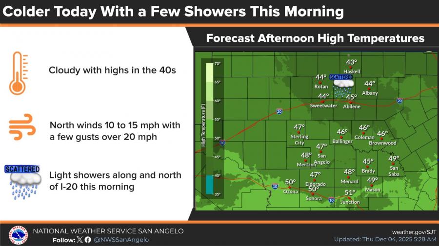
Today’s conditions remain cold and cloudy across the region, with highs only reaching the 40s. North winds between 10 and 15 mph, with gusts over 20 mph, and light morning showers north of I-20 accompanied the post-frontal air already in place.
Overnight lows across the Concho Valley are forecast to fall into the low- to mid-30s through the weekend. Dry weather is expected to hold through early next week.


Subscribe to the LIVE! Daily

Required
Post a comment to this article here: